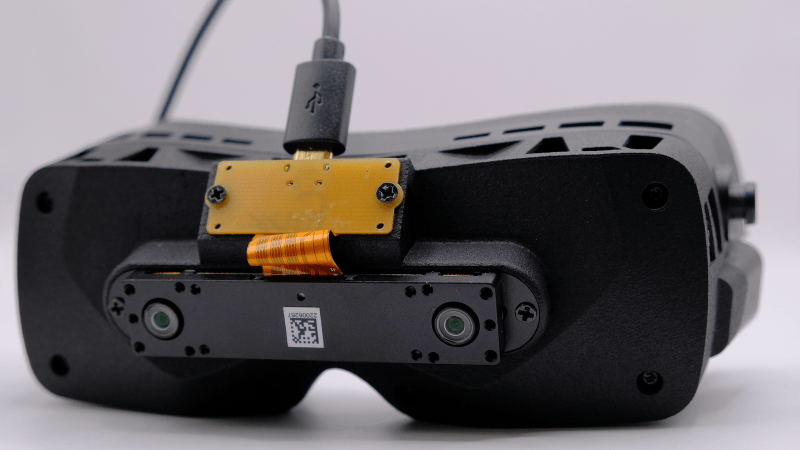
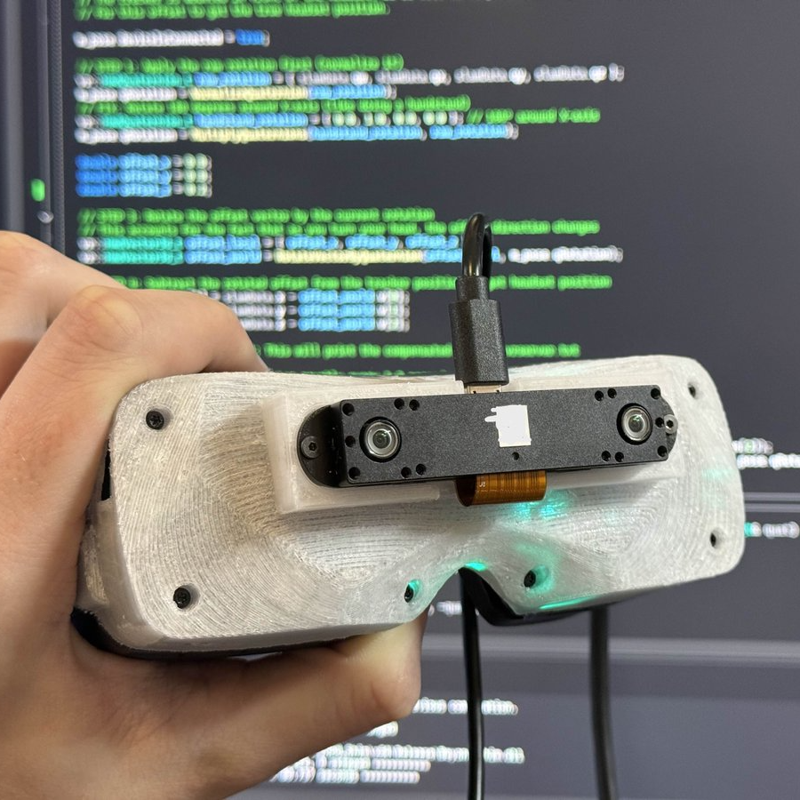
Those in the virtual reality scene might be interested in [Prohurtz]’s add-on for the Bigscreen Beyond VR headset. BSB-SLAM adds SLAM (Simultaneous Localization and Mapping) tracking to the headset by attaching a sensor to the front of the headset, and providing the software to tie the two together. As a result, the headset can be fully tracked in 3D space with no need for external base stations. It essentially adds inside-out tracking as a DIY add-on.
Just to be clear, that doesn’t mean the headset becomes wireless. The Beyond connects to a PC, essentially acting as a display, and that part is the same. But it does mean the headset is no longer tied to having to work in a room with base stations pre-installed.
[Prohurtz]’s solution does this by adding a small off-the-shelf Xvisio XR50 board, USB cable, and 3D-printed mount to the unit. The headset works as normal, just with some extra software needed to use the sensor data in lieu of the base stations.
As far as sensors go the Xvisio XR50 is a bit spendy, but the fact that a small and lightweight SLAM sensor that’s capable of delivering positioning data suitable for tracking a headset in near real-time can be bought online and so readily adapted is pretty interesting.
[Prohurtz] got the idea working back in 2025 but it’s now at the point where one can order a part, print an adapter, and be off to the races with a software package.
This isn’t [Prohurtz]’s first time with VR hardware, either. The EyeTrackVR eye tracking add-on is also their work, combining largely off-the-shelf hardware into an effective DIY solution for VR use.
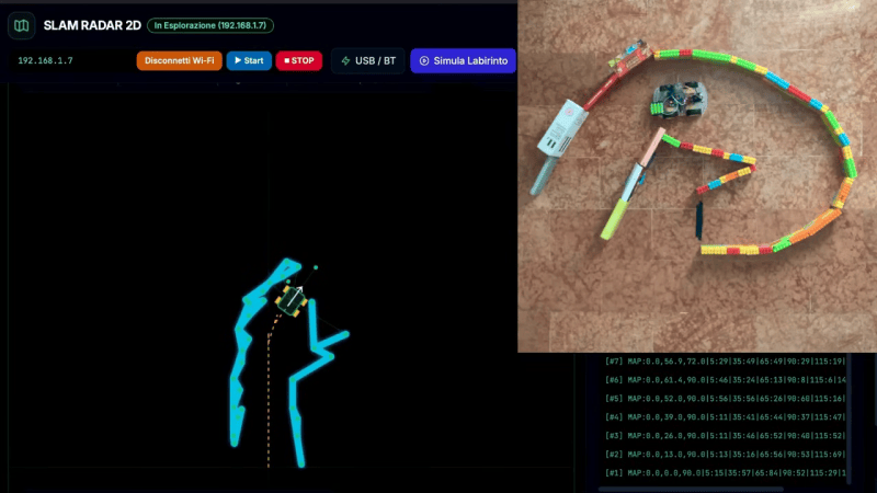
There are plenty of “robot” projects out there that are really just a small remote control platform of some sort. We often like to think of robots of having some sort of autonomy though. [Luca Fagioli] demonstrates a great example of this with his explorer robot that uses Simultaneous Localization and Mapping (SLAM) to navigate its environment.
The robot is a built on a small plastic chassis, with one gear motor per drive wheel. Running the show is an Arduino Uno R4 Wi-Fi, paired with the Sensor Shield 5.0 and an L298N motor driver board. There’s also an HC-SR04 ultrasonic sensor module onboard, mounted atop an SG-90 servo motor so it can be panned around. The ultrasonic sensor determines the range between the robot and surrounding walls, and a map is constructed at the same time as the robot is localizing itself within it. There are also infrared sensors on the bottom of the robot for detecting tape marks on the floor for checkpointing purposes.
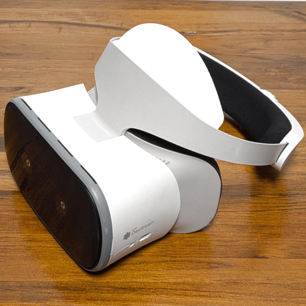
Some readers may recall the Lynx-R1 headset — it was conceived as an Android virtual reality (VR) and mixed reality (MR) headset with built-in hand tracking, designed to be open where others were closed, allowing developers and users access to inner workings in defiance of walled gardens. It looked very promising, with features rivaling (or surpassing) those of its contemporaries.
The unusual optics are memorable. (Hands-on Lynx-R1 by Antony Vitillo)
As a headset the Lynx-R1 had a number of intriguing elements. The unusual optics, the flip-up design, and built-in hand tracking were impressive for its time, as was the high-quality mixed reality pass-through. That last feature refers to the headset using its external cameras as inputs to let the user see the real world, but with the ability to have virtual elements displayed and apparently anchored to real-world locations. Doing this depends heavily on the headset being able to track its position in the real world with both high accuracy and low latency, and this is what ORB-SLAM3 provides.
A successful crowdfunding campaign for the Lynx-R1 in 2021 showed that a significant number of people were on board with what Lynx was offering, but developing brand new consumer hardware is a challenging road for many reasons unrelated to developing the actual thing. There was a hands-on at a trade show in 2021 and units were originally intended to ship out in 2022, but sadly that didn’t happen. Units still occasionally trickle out to backers and pre-orders according to the unofficial Discord, but it’s safe to say things didn’t really go as planned for the R1.
It remains a genuinely noteworthy piece of hardware, especially considering it was not a product of one of the tech giants. If we manage to get our hands on one of them, we’ll certainly give you a good look at it.
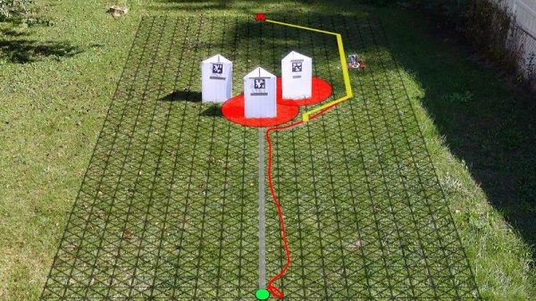
Sending teams of tiny drones to explore areas and structures is a staple in sci-fi and research, but the weight and size of sensors and the required processing power have long been a limiting factor. In the video below, a research team from [ETH Zurich] breaks through these limits, demonstrating indoor mapping with a swarm of tiny drones without dependence on any external systems.
The drone is the modular Crazyflie platform, which uses stackable PCBs (decks) to expand capabilities. The team added a Flow deck for altitude control and motion tracking, and a Loco positioning deck with a UWB module determining relative distances between drones. On top of this, the team added two custom decks. The first mounts four VL53L5CX 8×8 pixel TOF sensors for omnidirectional LIDAR scanning. The final deck does handles all the required processing with a GAP9 System-on-Chip, which features 10 RISC-V cores running on just 200 mW of power.
Of course the special sauce of this project lies in the software. The team developed a lightweight collaborative Simultaneous Localization And Mapping (SLAM) algorithm which can be distributed across all the drones in the swarm. It combines LIDAR scan data and the estimated position of the drone during the scan, and then overlays the data for the scans for each location across different drones, compensating for errors in the odometry data. The team also implemented inter-drone collision avoidance, packet collision avoidance and optimizing drones’ paths. The code is supposed to be available on GitHub, but the link was broken at the time of writing.
When we think of robotics, the first thing that usually comes to mind for many of us is some sort of industrial arm that’s bolted to the floor, or perhaps a semi-autonomous rover trudging its way across the dusty Martian landscape. While these two environments are about as different as can be, the basic “rules” are pretty much the same. Being on firm ground ground gives the robot a clear understanding of its position and orientation, which greatly simplifies tasks such as avoiding collisions or interacting with nearby objects.
But what happens when that reference point goes away? How does a robot navigate when it’s flying through open space or hovering in mid-air? That’s just one of the problems that fascinates Nick Rehm, who stopped by to host this week’s Aerial Robotics Hack Chat to talk about his passion for flying robots. He’s currently an aerospace engineer at Johns Hopkins Applied Physics Laboratory, where he works on the unique challenges faced by autonomous flying vehicles such as the detection and avoidance of mid-air collisions, as well as the development of vertical take-off and landing (VTOL) systems. But before he had his Master’s in Aerospace Engineering and Rotorcraft, he got started the same way many of us did, by playing around with DIY projects.
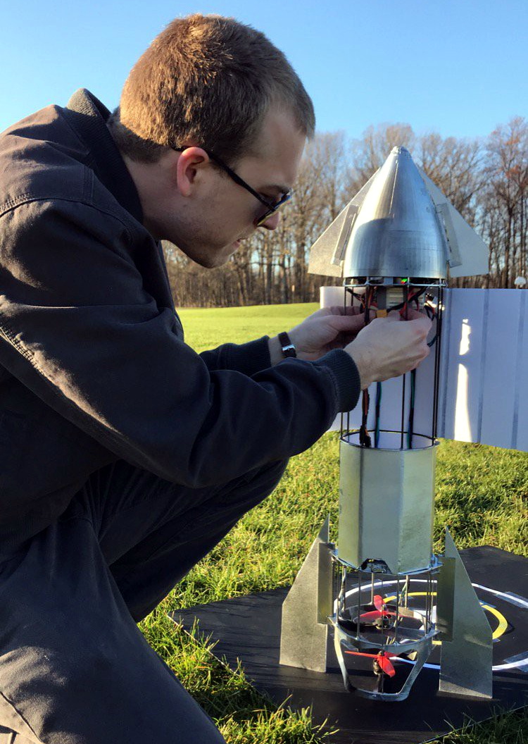
In fact, regular Hackaday readers will likely recall seeing some of his impressive builds. His autonomous ekranoplan designed to follow a target using computer vision graced the front page in April. Back in 2020, we took a look at his recreation of SpaceX’s Starship prototype, which used a realistic arrangement of control surfaces and vectored thrust to perform the spacecraft’s signature “Belly Flop” maneuver — albeit with RC motors and propellers instead of rocket engines. But even before that, Nick recalls asking his mother for permission to pull apart a Wii controller so he could use its inertial measurement unit (IMU) in a wooden-framed tricopter he was working on.
Discussing some of these hobby builds leads the Chat towards Nick’s dRehmFlight project, a GPLv3 licensed flight control package that can run on relatively low-cost hardware, namely a Teensy 4.0 microcontroller paired with the GY-521 MPU6050 IMU. The project is designed to let hobbyists easily experiment with VTOL craft, specifically those that transition between vertical and horizontal flight profiles, and has powered the bulk of Nick’s own flying craft.
Moving onto more technical questions, Nick says one of the most difficult aspects when designing an autonomous flying vehicle is getting your constraints nailed down. What he means by that is having a clear goal of what the craft needs to do, and critically, how long it needs to do it. How far does the craft need to be able to fly? How fast? Does it need to loiter at the target location, and if so, for how long? The answers to these questions will largely dictate the form of the final vehicle, and are key to determining if it’s worth implementing the complexity of transitioning from VTOL to fixed-wing horizontal flight.
But according to Nick, the biggest challenge in aerial robotics is onboard state estimation. That is, the ability for the craft to know its position and orientation relative to the ground. While high-performance computers have gotten lighter and sensors have improved, he says there’s still no substitute for having a ground-based tracking system. He mentions that those fancy demonstrations you’ve seen with drones flying in formation and working collaboratively towards a task will almost certainly have an array of motion capture cameras tucked off to the side. This makes for an impressive show, but greatly limits the practical application of these drone swarms.
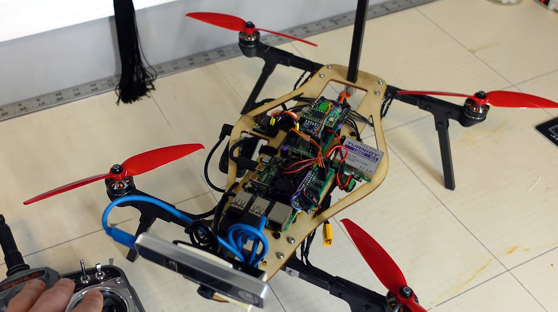
Nick’s custom Raspberry Pi 4-powered quadcopter lets him test autonomous flight techniques.
So what does the future of aerial robotics look like? Nick says open source projects like ArduPilot and PX4 are still great choices for hobbyists, but sees promise in newer platforms which pair the traditional autopilot with more onboard computing power, such as Auterion’s Skynode. More powerful flight controllers can enable techniques such as simultaneous localization and mapping (SLAM), which uses 3D scans of the environment to help the robot orient itself. He’s also very interested in technologies that enable autonomous flight in GPS-denied environments, which is critical for robotic craft that need to operate indoors or in situations where satellite navigation is unavailable or unreliable. In light of the incredible success of NASA’s Ingenuity helicopter, we imagine these techniques will also play an invaluable role in the future airborne exploration of Mars.
We want to thank Nick for hosting this week’s Aerial Robotics Hack Chat, which turned out to be one of the fastest hours in recent memory. His experience as both an avid hobbyist and a professional in the field provided exactly the sort of insight the Hackaday community looks for, and his gracious offer to keep in touch with several of those who attended the Chat to further discuss their projects speaks to how passionate he is about this topic. We expect to see great things from Nick going forward, and would love to have him join us again in the future to see what he’s been up to.
The Hack Chat is a weekly online chat session hosted by leading experts from all corners of the hardware hacking universe. It’s a great way for hackers connect in a fun and informal way, but if you can’t make it live, these overview posts as well as the transcripts posted to Hackaday.io make sure you don’t miss out.
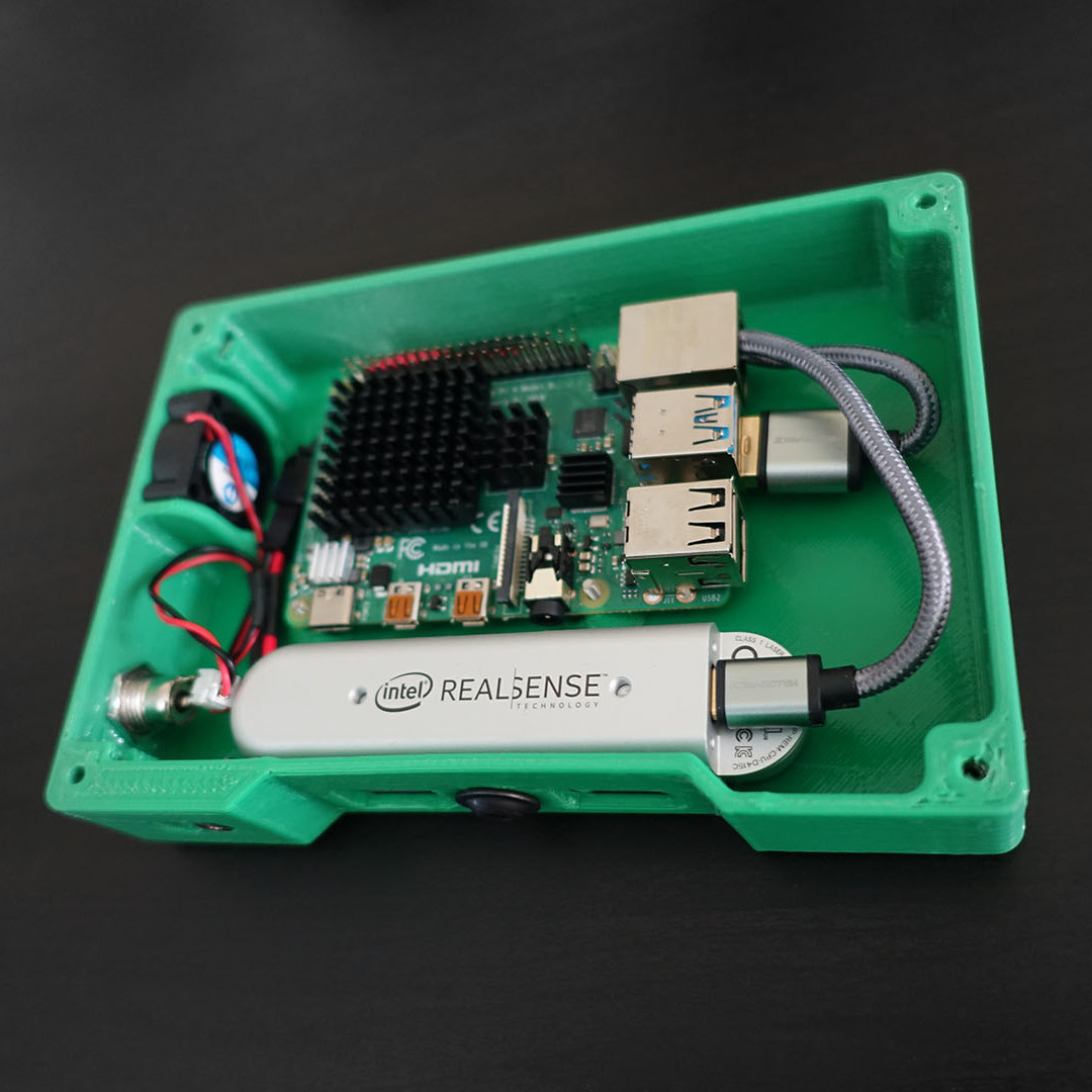
Raspberry Pi 4 (with USB 3.0) and Intel RealSense D415 depth sensing camera.
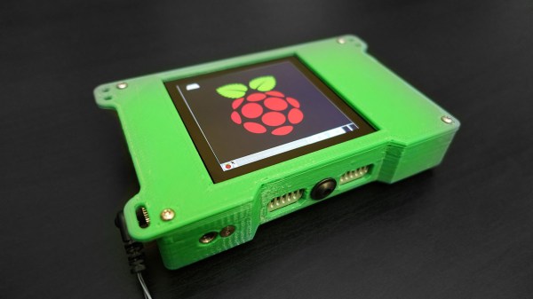
When the Raspberry Pi 4 came out, [Frank Zhao] saw the potential to make a realtime 3D scanner that was completely handheld and self-contained. The device has an Intel RealSense D415 depth-sensing camera as the main sensor, which uses two IR cameras and an RGB camera along with the Raspberry Pi 4. The Pi uses a piece of software called RTAB-Map — intended for robotic applications — to take care of using the data from the camera to map the environment in 3D and localize itself within that 3D space. Everything gets recorded in realtime.
This handheld device can act as a 3D scanner because the data gathered by RTAB-Map consists of a point cloud of an area as well as depth information. When combined with the origin of the sensing unit (i.e. the location of the camera within that area) it can export a point cloud into a mesh and even apply a texture derived from the camera footage. An example is shown below the break. Continue reading “Handheld 3D Scanning, Using Raspberry Pi 4 And Intel RealSense Camera”→
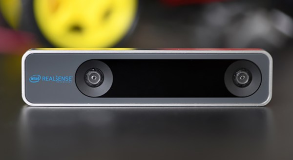
Robot cars, DIY or otherwise, are hot right now. To do this right, you’re going to need cameras, LIDAR, or some other way of sensing the the world. Intel is again getting into the fray with a RealSense tracking camera for simultaneous localization and mapping for robotics, drone, and augmented reality needs.
The tech specs for the Intel RealSense T265 are impressive for small robotics uses. It includes 6DoF tracking gathered by two cameras, each with a 170° FoV. Connection to a computer is through USB 2.0 or 3.0. If you want to get an idea of how seriously Intel is taking the ‘robotics, and other power- and weight-limited platforms’ market, here’s a sample of what is on the one-page spec sheet: the T265 only uses 1.5 Watts, weighs 55 grams, and is 108 x 25 x 13 mm. There are also two M3 taps spaced 50mm apart on the back, which is an astonishing spec to publish on the product landing page. Simply the fact that the location and dimensions of the mounting holes is so prominent gives you an idea of how seriously Intel is taking robotics and prototyping applications.
This new SLAM camera complements Intel’s other tracking camera offerings, including those we’ve seen at Maker Faires past. It’s a competitor to the new crop of solid state LIDAR modules we’ve seen pop up recently. It’s not a Kinect, but we’re years past using a first-gen Kinect for robotics applications. Now, everything is custom chips and SLAM processing, and the RealSense T265 is the smallest platform to do that now.