Plankton are tiny organisms that drift around in the ocean. They aren’t just whale food — they are responsible for fixing up to 50% of the world’s carbon dioxide. That, along with their position as the base of many important food chains, makes them interesting to science. Unfortunately, they are tiny and the ocean is huge. Enter Planktoscope. Billed as “an affordable modular quantitative imaging platform for citizen oceanography,” the device is a software-controlled microscope with the ability to deal with samples flowing through.
The software is in Python and uses existing libraries for user interface, image processing, and other tasks. The computing hardware is in the form of a Raspberry Pi. There are actually two prototypes of PlanktoScope available.
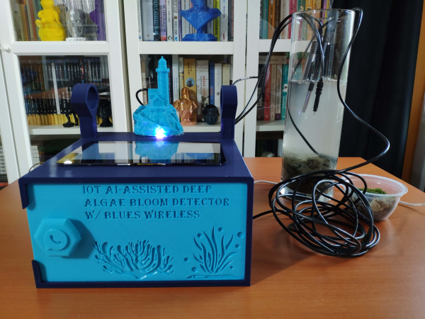
Harmful Algal Blooms (HABs) can have negative consequences for both marine life and human health, so it can be helpful to have early warning of when they’re on the way. Algal blooms deep below the surface can be especially difficult to detect, which is why [kutluhan_aktar] built an AI-assisted algal bloom detector.
After taking images of deep algal blooms with a boroscope, [kutluhan_aktar] trained a machine learning algorithm on them so a Raspberry Pi 4 could recognize future occurrences. For additional water quality information, the device also has an Arduino Nano connected to pH, TDS (total dissolved solids), and water temperature sensors which then are fed to the Pi via a serial connection. Once a potential bloom is spotted, the user can be notified via WhatsApp and appropriate measures taken.
Stand by the shore and watch the waves roll in, and you’ll notice that most come in at roughly the same size. There’s a little variation, but the overwhelming majority don’t stand out from the crowd. On all but the stormiest of days, they have an almost soothing regularity about them.
Every so often though, out on the high seas, a rogue wave comes along. These abnormally large waves can strike with surprise, and are dangerous to even the largest of ships. Research is ongoing as to what creates these waves, and how they might be identified and tracked ahead of time.
Every summer you go down the shore, but lately you’ve begun to notice that the beach seems narrower each time you visit. Is that the sea level rising, or is the sand just being swept away? Speaking of sea levels, you keep hearing that they rise higher every year — but how exactly is that measured? After all, you can’t exactly use a ruler. As it turns out, there are a number of clever systems in place that can accurately measure the global sea level down to less than an inch and a half.
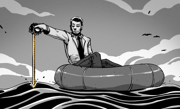
Not only are waves always rippling across the ocean’s surface, but tides periodically roll in and out, making any single instantaneous measurement of sea level hopelessly inaccurate. Even if you plan to take hundreds or thousands of measurements over the course of weeks or months, taking the individual measurements is still difficult. Pick a nice, stable rock in the surf, mark a line on it, and return every hour for two weeks to hold a tape measure up to it. At best you’ll get within six inches on each reading, no matter what you’ll get wet, and at worst the rock will move and you’ll get a damp notebook full of useless numbers. So let’s take a look at how the pros do it.
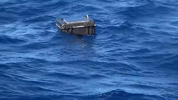
It may be named after the most famous volleyball in history, but “Wilson” isn’t just a great conversationalist. [Hayden Brophy] built the free-drifting satellite buoy to see if useful science can be done with off-the-shelf hardware and on a shoestring budget. And from the look of the data so far, Wilson is doing pretty well.
Wilson belongs to a class of autonomous vessels known as drifters, designed to float along passively in the currents of the world’s ocean. The hull of [Hayden]’s drifter is a small Pelican watertight case, which contains all the electronics: Arduino Pro Trinket, GPS receiver, a satellite modem, and a charger for the LiPo battery. The lid of the case is dominated by a 9 W solar panel, plus the needed antennas for GPS and the Iridium uplink and a couple of sensors, like a hygrometer and a thermometer. To keep Wilson bobbing along with his solar panel up, there’s a keel mounted to the bottom of the case, weighted with chains and rocks, and containing a temperature sensor for the water.
Wilson is programmed to wake up every 12 hours and uplink position and environmental data as he drifts along. The drifter was launched into the heart of the Gulf Stream on August 8, about 15 nautical miles off Marathon Key in Florida, by [Captain Jim] and the very happy crew of the “Raw Deal”. As of this writing, the tracking data shows that Wilson is just off the coast of Miami, 113 nautical miles from launch, and drifting along at a stately pace of 2.5 knots. Where the buoy ends up is anyone’s guess, but we’ve seen similar buoys make it all the way across the Atlantic, so here’s hoping that hurricane season is kind to Wilson.
We think this is great, and congratulations to [Hayden] for organizing a useful and interesting project.
With Earth in the throes of climate change and no suitable Planet B lined up just yet, oceanography is as important now as it has ever been. And yet, the instruments relied upon for decades to test ocean conditions are holding steady within the range of expensive to prohibitively expensive. Like any other area of science, lowering the barrier of entry has almost no disadvantages — more players means more data, and that means more insight into the inner workings of the briny deep.
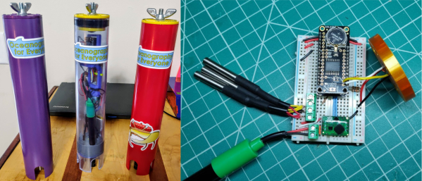
[Oceanography for Everyone] aims to change all that by showing the world just how easy it is to build an oceanographic testing suite that measures conductivity (aka salinity), temperature, and depth using common components. OpenCTD is designed primarily for use on the continental shelf, and has been successfully tested to a depth of 100 meters.
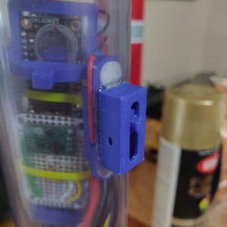
An Adalogger M0 and RTC Featherwing run the show from their waterproof booth in the center of the PVC tube. There’s a 14-bar pressure sensor for depth, a trio of DS18B20s for temperature averaging, and a commercial conductivity probe that gathers salinity data. These sensors are fed through a 3D-printed base plate and ultimately potted in stainless steel epoxy. The other end of the tube is sealed with a mechanical plug that seats and unseats with the whirl of a wingnut.
We particularly like the scratch-built magnetic slide switch that turns OpenCTD on and off without the need to open the cylinder. If you’d like to build one of these for yourself, take a deep dive into [Oceanography for Everyone]’s comprehensive guide — it covers the components, construction, and calibration in remarkable detail. The switch is explained starting on page 50. You can find out more about the work Oceanography for Everyone is doing at their site.
It looks like a ship when it is in port or in transit, and when it use you’d think it’s about to sink. The RP FLIP (for “FLoating Instrument Platform) is an unpowered research buoy with a very special design designed to provide the most stable and vibration-free platform possible for scientists studying the properties of the sea.
Scientific research often places demanding requirements upon existing infrastructure, requiring its own large projects tailored to their individual task. From these unusual needs sometimes come the most curious buildings and machinery. RP FLIP is designed to provide the most stable and vibration-free platform possible for scientists studying the properties of the sea. By flooding tanks in its bow it transfers from horizontal and floating on the surface to vertical and half-submerged when it is deployed. With its stern protruding from the water and pointing skywards it has the appearance of a sinking ship. What’s really neat is that its interior is cleverly designed such that its crew can operate it in either horizontal or vertical positions.
The original impetus for FLIP’s building was the US Navy’s requirement to understand the properties of sound waves in the ocean with relation to their submarines and presumably also those of their Soviet adversaries. Research submarines of the 1950s were not stable enough for reliable measurements, and the FLIP, launched in 1962, was built to address this by providing a far more stable method of placing a hydrophone at depth. Since then it has participated in a significant number of other oceanographic studies as diverse as studying the propagation of waves across the Pacific, and the depth to which whales dive.
The videos below should give a good introduction to the craft. The first one is a glossy promotional video from its operator, the Scripps Institution Of Oceanography, on its 50th anniversary, while the lower of the two is a walkaround by a scientist stationed aboard. In this we see some of the features for operating in either orientation, such as a toilet facilities mounted at 90 degrees to each other.
It appears that FLIP is in good order and with continuing demand for its services that should see it still operating well into the future. Those of us who live near Atlantic waters may never see it in person but it remains one of the most unusual and technically intriguing vessels afloat.