Star Trackers: Telling Up From Down In Any Space

Keeping track of position is crucial in a lot of situations. On Earth, it’s usually relatively straight-forward, with systems having been developed over the centuries that would allow one to get at least a rough fix on one’s position on this planet. But for a satellite out in space, however, it’s harder. How do they keep their communications dishes pointed towards Earth?

The stars are an obvious orientation point. The Attitude and Articulation Control Subsystem (AACS) on the Voyager 1 and 2 space probes has the non-enviable task of keeping the spacecraft’s communication dish aligned precisely with a communications dish back on Earth, which from deep space is an incomprehensibly tiny target.

Back on Earth, the star tracker concept has become quite popular among photographers who try to image the night skies. Even in your living room,  VR systems also rely on knowing the position of the user’s body and any peripherals in space. In this article we’ll take a look at the history and current applications of this type of position tracking. Continue reading “Star Trackers: Telling Up From Down In Any Space”

DIY Autonomous Mower In The Wild

Mowing the lawn is one of those repetitive tasks most of us really wish we had a robot for. [Kenny Trussell] mowing needs are a bit more strenuous than most backyards, so he hacked a ride-on mower to handle multi-acre fields all on it’s own.

The mower started out life as a standard zero turn ride on lawn mower. It’s brains consist of a PixHawk board running Ardurover, an Ardupilot derivative for ground vehicles. Navigation is provided by a RTK GPS module that gets error corrections from a fixed base station via an Adafruit LoRa feather board, to achieve centimetre level accuracy. To control the mower, [Kenny] replaced the pneumatic shocks that centred the control levers with linear actuators.

So far [Kenny] has been using the mower to cut large 5-18 acre fields, which would be a very time-consuming job for a human operator. A relay was added to the existing safety circuit that only allows the mower to function when there is weight on the seat. This relay is wired directly to the RC receiver and is controlled from the hand-held RC transmitter. It will also stop the mower if it loses signal to the transmitter. To set up mowing missions, [Kenny] uses the Ardupilot Mission Planner for which he wrote a custom command line utility to create a concentric route for the mower to follow to completely cover a defined area. He has made a whole series of videos on the process, which is very handy for anyone wanting to do the same. We’re looking forward to a new video with all the latest updates.

This mower has been going strong for two years, but in terms of hours logged it’s got nothing on this veteran robotic mower that’s been at it for more than two decades and still runs off an Intel 386 processor.

Traffic Updates On The Seven Seas: Open Source Chart Plotter Using A Raspberry Pi

As the Raspberry Pi in its various forms continues to flow into the wild by the thousands, it’s interesting to see its user base expand outside beyond the hacker communities. One group of people who’ve also started taking a liking to it is sailing enthusiasts. [James Conger] is one such sailor, and he built his own AIS enabled chart plotter for a fraction of the price of comparable commercial units.

AIS transponders in the Mediterranean. VesselFinder

Automatic Identification System (AIS) is a GPS tracking system that uses transponders to transmit a ship’s position data to other ships or receiver stations in an area. This is used for collision avoidance and by authorities (and hobbyists) to keep an eye on shipping traffic, and allow for stricken vessels to be found easily. [James]’ DIY chart plotter overlays the received AIS data over marine charts on a nice big display. A Raspberry Pi 3B+, AIS Receiver Hat, USB GPS dongle and a makes up the core of the system. The entire setup cost about $350. The Pi runs OpenCPN, an open source chart plotter and navigation software package that [John] says is rivals most commercial software. As most Pi users will know the SD card is often a weak link, so it’s probably worth having a backup SD card with all the software already installed just in case it fails during a voyage.

We’ve seen AIS receiver stations built using the RTL-SDR, as well as a number of projects around the AIS equivalent in aviation, ADS-B. Check out [John]’s video after the break. Continue reading “Traffic Updates On The Seven Seas: Open Source Chart Plotter Using A Raspberry Pi”

Navigate Around Garmin’s Custom Map Limits

If your only experience with Garmins is from that one rental car a few years back, it may surprise you that some of them, mostly the handheld outdoor units, allow custom maps. This sounds cool until you find out the limitations. Unless you upgrade to premium, it doesn’t allow map files larger than 3MB. What’s worse, it will choke the resolution of maps larger than one megapixel. Well, bust out your virtual hiking boots, because [facklere]’s gonna take you down the trail of DIY digital cartography.

You can use any map you want as long as its not completely fictional (although wandering the maps of middle-earth would be a fun hack on top of this one). Your map can be paper, PDF, or parchment; it just has to be converted to JPEG. The map [facklere] wanted to use was a huge PDF, so as a bonus, he shows how to get from PDF to JPEG in GIMP. Then comes the fiddly part — rooting the map in reality by overlaying it on real roads using Google Earth.

You’ve still got a huge map. Now what? The secret sauce is tiling. [facklere] used KMZfactory, a free map editor for Garmin maps that goes the extra mile to split the tiles for you, keeping them under the 1MP limit. Once that’s done, just upload it to your unit and hit the road.

Got an old Garmin that won’t do custom maps? See if you can get DOOM up and running on it.

Maps To SMS, When You’re Really Far Away

GPS is available on most smart phones, which is all well and good unless you drive out into a place with weak service. Unless you want to go into the before-time and buy a standalone GPS (and try to update the maps every so often) or go even further back and print out MapQuest directions, you’ll need another solution to get directions. Something like this project which sends Google Maps directions over SMS.

The project is called RouteMe by [AhadCove]. It runs on a Raspberry Pi at his home which is constantly monitoring an email inbox. Using Google Voice to forward incoming text messages as emails to the Pi, the system works when your phone has a cell signal but no data connection. The Pi listens for specific commands in that SMS-to-Email connection and is able to send directions back to the phone via text message. That’s actually a neat hack you may remember from the olden days where you can send email as SMS using the phone number as the address.

If you find yourself lost in the woods with just your phone often enough, [AhadCove] has all of the code and detailed directions on how to set this up on his GitHub site. But don’t discount this particular task, anything you can script on the Pi can now be controlled via SMS without relying on a service like Twilio.

This maps hack is a pretty ingenious solution to a problem that more than a few of us have had, and it uses a lot of currently-available infrastructure to run as well. If you want another way of navigating without modern tech, have a go at dead reckoning in a car.

3 Words To Describe Any Spot On Earth

For quite a long while now, latitude and longitude has been the way humankind has navigated the globe. This is a perfectly workable system, but it’s a little overwrought for daily use by the layperson. What3Words seeks to provide a simpler solution.

The system is based on splitting the surface of the globe into a grid of 3 m x 3 m sections. This includes oceans and bodies of water. With the grid layed out, each section is given a name consisting of three English words strung together. For example, ///eggs.form.breakfast denotes a spot in the outskirts of Chengdu, China, while ///crops.cards.gifts is a good approximation of that spot where the Naked Cowboy hangs out in Times Square, New York.

Addresses in this format are written with three leading forward slashes, along with a dot between each word. An attempt has been made to only use uncontroversial words, as well as to make sure no crude addresses are created by awkward combinations. Don’t worry, we checked – but if you do find anything good, drop it in the comments below.

It’s a tool that’s been around for a while, but an interesting one nonetheless. It’s something that needs a wider societal acceptance to become truly useful; we imagine it could be good in a small social circle once everyone is familiar with it. It may yet catch on – only time will tell!

Tracking The Satellites That Keep Us On Track; Monitoring GPS, Galileo, BeiDou, And GLONASS

We may not always be aware of it, but the daily function of the technological world around us is extremely dependent on satellite navigations systems. It helps the DHL guy deliver those parts you were waiting for, and keeps the global financial and communication systems running with precision timing. So, when these systems have a bad day, they can spread misery across the globe. To keep an eye on these critical constellations, [Bert Hubert] and friends set up a global open source monitoring network that aims to track every satellite in the GPS, Galileo, BeiDou and GLONASS constellations.

Local azimuth and local elevation of GPS, Galileo, and BeiDou satellites passing overhead [via @GalileoSats]
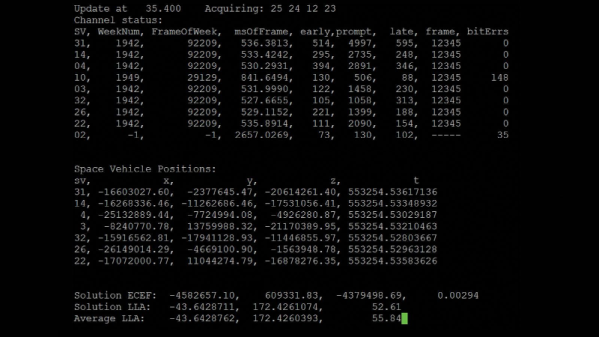
Off-the-shelf GNSS receivers are used to feed navigation messages to a machine running Linux/OSX/OpenBSD. The messages are processed to calculate the position (ephemeris), extract atomic clock timings and status codes of each satellite. Publicly available orbital data is then used to make an informed guess regarding the identity of the satellite in question.

All this data enables [Bert] to determine ephemeris discontinuities, time offsets, and atomic clock jumps. The project’s twitter feed, @GalileoSats, is very active with interesting updates. Go check it out! All the collected data is available for research purposes and the software is up on Github.

GPS hacks are never in short supply around here and another open source satellite network, SatNOGS has been featured a number of times on Hackaday after it won the 2014 Hackaday Prize.

Thanks for the tip [DarkSideDave]!