Alfred Jones Talks About The Challenges Of Designing Fully Self-Driving Vehicles

The leap to self-driving cars could be as game-changing as the one from horse power to engine power. If cars prove able to drive themselves better than humans do, the safety gains could be enormous: auto accidents were the #8 cause of death worldwide in 2016. And who doesn’t want to turn travel time into something either truly restful or alternatively productive?

But getting there is a big challenge, as Alfred Jones knows all too well. The Head of Mechanical Engineering at Lyft’s level-5 self-driving division, his team is building the roof racks and other gear that gives the vehicles their sensors and computational hardware. In his keynote talk at Hackaday Remoticon, Alfred Jones walks us through what each level of self-driving means, how the problem is being approached, and where the sticking points are found between what’s being tested now and a truly steering-wheel-free future.

Check out the video below, and take a deeper dive into the details of his talk.

Continue reading “Alfred Jones Talks About The Challenges Of Designing Fully Self-Driving Vehicles”

The Ground Beneath Your Feet: SuperAdobe Construction

Homes in different parts of the world used to look different from each other out of necessity, built to optimize for the challenges and benefits of local climate. When residential climate control systems became commonplace that changed. Where a home in tropical south Florida once required very different building methods (and materials) compared to a home in the cold mountains of New England, essentially identical construction methods are now used for single-family homes in any climate. The result is inefficient and virtually indistinguishable housing from coast to coast, regardless of climate. As regions throughout the world are facing increasingly dire housing shortages, the race is on to find solutions that are economical and available to us right now.

The mission of CalEarth, one of the non-profits that Hackaday has teamed up with for this year’s Hackaday Prize, is to address that housing shortage by building energy-efficient homes out of materials already available in the areas that they will be built. CalEarth specializes in building adobe, or earth, homes that have a large thermal mass and an inexpensive bill of materials. Not only does this save on heating and cooling costs, but transportation costs for materials can be reduced as well. Some downside to this method of construction are increased labor costs and the necessity of geometric precision of the construction method, both of which are tackled in this two-month design challenge.

Continue reading “The Ground Beneath Your Feet: SuperAdobe Construction”

Jetson Nano Robot

[Stevej52] likes to build things you can’t buy, and this Jetson Nano robot falls well within that category. Reading the project details, you might think [Stevej52] drinks too much coffee. But we think he is just excited to have successfully pulled off the Herculean task of integrating over a dozen hardware and software modules. Very briefly, he is running Ubuntu and ROS on the PC and Nano. It is all tied together with Python code, and is using Modbus over IP to solve a problem getting joystick data to the Nano. We like it when existing, standard protocols can be used because it frees the designer to focus more on the application. Modbus has been around for 40 years, has widespread support in many languages and platforms.

This is an ongoing project, and we look forward to seeing more updates and especially more video of it in action like the one found below. With the recent release of a price-reduced Jetson Nano, which we covered last week, this might be an excellent project to take on.

Continue reading “Jetson Nano Robot”

LIDAR Built On Familiar Platform

Moore’s law may have reached its physical limit for transistor density, but plenty of other technologies are still on that familiar path of getting smaller and smaller as time passes. It looks like LIDAR is no exception to this trend either. This project from [Owen] shows a fully-functional LIDAR system for about $20 and built almost entirely on top of an ESP32.

The build uses a Time-Of-Flight IR laser range sensor controlled by the ESP32, and the sensor is much smaller than even the ESP32’s footprint so it takes up very little extra space. To get it to function as a LIDAR system instead of just a simple rangefinder it does need a motor in order to rotate itself to see its entire space. Besides its small form factor and low cost, it also has a handy user interface that can run anywhere an HTML5 browser can run, making the use of the system easy and straightforward as well. All of the code is available on the project’s GitHub page.

We wouldn’t expect a system like this to be driving an autonomous car anytime soon, it’s update rate is far too slow, but its intent for small robots and even as an educational demo for learning LIDAR is second to none. If you do need a little more power in a LIDAR system but still don’t want to break the bank, we featured this impressive setup a few weeks ago.

LIDAR System Isn’t Just A Rangefinder Anymore

For any project there’s typically a trade-off between quality and cost,as higher quality parts, more features, or any number of aspects of a project can drive its price up. It seems as though [iliasam] has managed to avoid this paradigm entirely with his project. His new LIDAR system knocks it out of the park on accuracy, sampling, and quality, and somehow manages to only cost around $114 in parts.

A LIDAR system works by sending out many pulses of light in different directions, measuring the reflections of that light as it returns. LIDAR systems therefore improve with higher frequency pulses and faster control electronics for both the laser output and the receiving data. This system manages to be accurate to within a few centimeters and works up to 25 meters all while operating at 15 scans per second. The key was a high-powered laser module which can output up to 75 watts for extremely short times. More details can be found at this page (Google Translate from Russian).

Another bonus from this project is that [iliasam] has made everything available from his GitHub page including hardware specifications, so as long as you have a 3D printer this won’t take long to produce either. There’s even detailed breakdowns of how the laser driving circuitry works, and how there are safety features built in to keep anyone’s vision from accidentally getting damaged. Needless to say, this isn’t just a laser rangefinder module but if you want to see how you can repurpose those, [iliasam] can show you that as well.

Subterranean Uses For LIDAR: Cave Surveys

LIDAR has gained much popularity as a means for self-driving cars to survey the space around them. At their most basic, LIDAR is a surveying method that uses lasers to paints the space around the sensors and assembles the distances measured from reflected light into a digital three-dimensional representation. That’s something that has quite a number of other applications, from surveying ancient ruins and rainforests from a bird’s eye view to developing 3D models of indoor spaces.

One fascinating use of LIDAR technology is to map out the routes inside caves, subterranean spaces that are seldom accessed by humans apart from those with specialized equipment and knowledge of how to safely traverse the underground terrain. [caver.adam] has been working on his Open LIDAR project for a few years using an SF30-B High Speed Rangefinder and laser device for a dual-system atop a gimbal with stepper motors for cave scanning.

Originally an entry in the 2016 Hackaday Prize, [Adam] has continued to work on the project. The result shown in the video below is a cheaper 3D LIDAR setup that works by rotating the laser distance module on 2 axes with a sensor centered at the center of rotation. It works for volumetric calculations, detects change over time, and identifies various water patterns and rocks on a surface map. Compared to notebooks, tape measures, and compasses, it’s certainly a step up in cave surveying technology.

Check out some other past underground surveying projects, such as Iowa City’s beer caves scanning projects and National Geographic’s 2014 expedition of the Titan Chamber in southern Guizhou Province in China.

Continue reading “Subterranean Uses For LIDAR: Cave Surveys”

When Will Our Cars Finally Speak The Same Language? DSRC For Vehicles

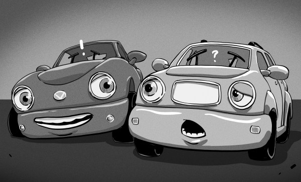
At the turn of the 21st century, it became pretty clear that even our cars wouldn’t escape the Digital Revolution. Years before anyone even uttered the term “smartphone”, it seemed obvious that automobiles would not only become increasingly computer-laden, but they’d need a way to communicate with each other and the world around them. After all, the potential gains would be enormous. Imagine if all the cars on the road could tell what their peers were doing?

Forget about rear-end collisions; a car slamming on the brakes would broadcast its intention to stop and trigger a response in the vehicle behind it before the human occupants even realized what was happening. On the highway, vehicles could synchronize their cruise control systems, creating “flocks” of cars that moved in unison and maintained a safe distance from each other. You’d never need to stop to pay a toll, as your vehicle’s computer would communicate with the toll booth and deduct the money directly from your bank account. All of this, and more, would one day be possible. But only if a special low-latency vehicle to vehicle communication protocol could be developed, and only if it was mandated that all new cars integrate the technology.

Except of course, that never happened. While modern cars are brimming with sensors and computing power just as predicted, they operate in isolation from the other vehicles on the road. Despite this, a well-equipped car rolling off the lot today is capable of all the tricks promised to us by car magazines circa 1998, and some that even the most breathless of publications would have considered too fantastic to publish. Faced with the challenge of building increasingly “smart” vehicles, manufacturers developed their own individual approaches that don’t rely on an omnipresent vehicle to vehicle communication network. The automotive industry has embraced technology like radar, LiDAR, and computer vision, things which back in the 1990s would have been tantamount to saying cars in the future would avoid traffic jams by simply flying over them.

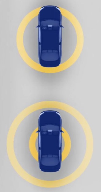
In light of all these advancements, you might be surprised to find that the seemingly antiquated concept of vehicle to vehicle communication originally proposed decades ago hasn’t gone the way of the cassette tape. There’s still a push to implement Dedicated Short-Range Communications (DSRC), a WiFi-derived protocol designed specifically for automotive applications which at this point has been a work in progress for over 20 years. Supporters believe DSRC still holds promise for reducing accidents, but opponents believe it’s a technology which has been superseded by more capable systems. To complicate matters, a valuable section of the radio spectrum reserved for DSRC by the Federal Communications Commission all the way back in 1999 still remains all but unused. So what exactly does DSRC offer, and do we really still need it as we approach the era of “self-driving” cars?

Continue reading “When Will Our Cars Finally Speak The Same Language? DSRC For Vehicles”