The Unique Challenges Of Aerial Robotics

When we think of robotics, the first thing that usually comes to mind for many of us is some sort of industrial arm that’s bolted to the floor, or perhaps a semi-autonomous rover trudging its way across the dusty Martian landscape. While these two environments are about as different as can be, the basic “rules” are pretty much the same. Being on firm ground ground gives the robot a clear understanding of its position and orientation, which greatly simplifies tasks such as avoiding collisions or interacting with nearby objects.

But what happens when that reference point goes away? How does a robot navigate when it’s flying through open space or hovering in mid-air? That’s just one of the problems that fascinates Nick Rehm, who stopped by to host this week’s Aerial Robotics Hack Chat to talk about his passion for flying robots. He’s currently an aerospace engineer at Johns Hopkins Applied Physics Laboratory, where he works on the unique challenges faced by autonomous flying vehicles such as the detection and avoidance of mid-air collisions, as well as the development of vertical take-off and landing (VTOL) systems. But before he had his Master’s in Aerospace Engineering and Rotorcraft, he got started the same way many of us did, by playing around with DIY projects.

In fact, regular Hackaday readers will likely recall seeing some of his impressive builds. His autonomous ekranoplan designed to follow a target using computer vision graced the front page in April. Back in 2020, we took a look at his recreation of SpaceX’s Starship prototype, which used a realistic arrangement of control surfaces and vectored thrust to perform the spacecraft’s signature “Belly Flop” maneuver — albeit with RC motors and propellers instead of rocket engines. But even before that, Nick recalls asking his mother for permission to pull apart a Wii controller so he could use its inertial measurement unit (IMU) in a wooden-framed tricopter he was working on.

Discussing some of these hobby builds leads the Chat towards Nick’s dRehmFlight project, a GPLv3 licensed flight control package that can run on relatively low-cost hardware, namely a Teensy 4.0 microcontroller paired with the GY-521 MPU6050 IMU. The project is designed to let hobbyists easily experiment with VTOL craft, specifically those that transition between vertical and horizontal flight profiles, and has powered the bulk of Nick’s own flying craft.

Moving onto more technical questions, Nick says one of the most difficult aspects when designing an autonomous flying vehicle is getting your constraints nailed down. What he means by that is having a clear goal of what the craft needs to do, and critically, how long it needs to do it. How far does the craft need to be able to fly? How fast? Does it need to loiter at the target location, and if so, for how long? The answers to these questions will largely dictate the form of the final vehicle, and are key to determining if it’s worth implementing the complexity of transitioning from VTOL to fixed-wing horizontal flight.

But according to Nick, the biggest challenge in aerial robotics is onboard state estimation. That is, the ability for the craft to know its position and orientation relative to the ground. While high-performance computers have gotten lighter and sensors have improved, he says there’s still no substitute for having a ground-based tracking system. He mentions that those fancy demonstrations you’ve seen with drones flying in formation and working collaboratively towards a task will almost certainly have an array of motion capture cameras tucked off to the side. This makes for an impressive show, but greatly limits the practical application of these drone swarms.

Nick’s custom Raspberry Pi 4-powered quadcopter lets him test autonomous flight techniques.

So what does the future of aerial robotics look like? Nick says open source projects like ArduPilot and PX4 are still great choices for hobbyists, but sees promise in newer platforms which pair the traditional autopilot with more onboard computing power, such as Auterion’s Skynode. More powerful flight controllers can enable techniques such as simultaneous localization and mapping (SLAM), which uses 3D scans of the environment to help the robot orient itself. He’s also very interested in technologies that enable autonomous flight in GPS-denied environments, which is critical for robotic craft that need to operate indoors or in situations where satellite navigation is unavailable or unreliable. In light of the incredible success of NASA’s Ingenuity helicopter, we imagine these techniques will also play an invaluable role in the future airborne exploration of Mars.

We want to thank Nick for hosting this week’s Aerial Robotics Hack Chat, which turned out to be one of the fastest hours in recent memory. His experience as both an avid hobbyist and a professional in the field provided exactly the sort of insight the Hackaday community looks for, and his gracious offer to keep in touch with several of those who attended the Chat to further discuss their projects speaks to how passionate he is about this topic. We expect to see great things from Nick going forward, and would love to have him join us again in the future to see what he’s been up to.


The Hack Chat is a weekly online chat session hosted by leading experts from all corners of the hardware hacking universe. It’s a great way for hackers connect in a fun and informal way, but if you can’t make it live, these overview posts as well as the transcripts posted to Hackaday.io make sure you don’t miss out.

Knowing Your Place: The Implications Of GPS Spoofing And Jamming

Artificial satellites have transformed the world in many ways, not only in terms of relaying communication and for observing the planet in ways previously inconceivable, but also to enable incredibly accurate navigation. A so-called global navigation satellite system (GNSS), or satnav for short, uses the data provided by satellites to pin-point a position on the surface to within a few centimeters.

The US Global Positioning System (GPS) was the first GNSS, with satellites launched in 1978, albeit only available to civilians in a degraded accuracy mode. When full accuracy GPS was released to the public under the 1990s Clinton administration, it caused a surge in the uptake of satnav by the public, from fishing boats and merchant ships, to today’s navigation using nothing but a smartphone with its built-in GPS receiver.

Even so, there is a dark side to GNSS that expands beyond its military usage of guiding cruise missiles and kin to their target. This comes in the form of jamming and spoofing GNSS signals, which can hide illicit activities from monitoring systems and disrupt or disable an enemy’s systems during a war. Along with other forms of electronic warfare (EW), disrupting GNSS signals form a potent weapon that can render the most modern avionics and drone technology useless.

With this in mind, how significant is the threat from GNSS spoofing in particular, and what are the ways that this can be detected or counteracted?

Continue reading “Knowing Your Place: The Implications Of GPS Spoofing And Jamming”

E-Paper Clock Displays Things In A Battery-Friendly Manner

Clock builds are a hacker staple, and many overflow with power-thirsty LEDs and network features. This build from [mattwach] takes quite the opposite approach, sipping away at its batteries thanks to an e-paper based design.

The build relies on a small Waveshare e-paper module which only requires power when the display is actually changing. When static, the display needs no electricity, and this helps save a great amount of power compared to OLED or LCD-based clocks.

An Atmega328p is the heart of the build, running off a 32.768 KHz clock crystal for a combination of precise timekeeping and low power draw. Time is ensured to be both precise and accurate thanks to a GPS module which allows the clock to sync to satellite time when powered up. It’s a common way to sync clocks to a high-quality time source. Most of the time, though, the GPS is kept powered down to save the 30-100 mA that the module typically draws when in use.

Other features include a temperature, humidity, and pressure sensor, with ambient pressure graphed over time. There’s also notification of sunrise and sunset times, along with the current phase of the moon. It’s all wrapped up in a case tastefully manufactured using 3D printed parts and some wooden CNC-cut panels for a nice rustic look.

With the e-paper display and the microcontroller configured for low-power operation, the clock will run for around 6 months on four AAA cells. Overall, it’s a nifty little clock that will provide the time, date, and other information without the need for an Internet connection. Video after the break.

Continue reading “E-Paper Clock Displays Things In A Battery-Friendly Manner”

OpenMower: Open Source Robotic Lawn Mower With RTK GPS

Robotic mowers are becoming a common sight in some places, enabled by the cost of motors and the needed control electronics being much lower, thanks to the pace of modern engineering. But, in many cases, they still appear to be really rather dumb, little more than a jacked up bump-and-go with a spinning blade. [Clemens Elflein] has taken a cheap, dumb mower and given it a brain transplant based around a Raspberry Pi 4 paired up with a Raspberry Pi Pico for the real time control side of things. [Clemens] is calling this OpenMower, with the motivation to create an open source robot mower controller with support for GPS navigation, using RTK for extra precision.

The donor robot was a YardForce Classic 500, and after inspection of the control PCB, it looks like many other robot mower models are likely to use the same controller and thus be compatible with the openmower platform. A custom mainboard houses the Pi 4 and Pico, an ArduSimple RTK GPS module (giving a reported navigational accuracy of 1 cm,) as well as three BLDC motor drivers for the wheels and rotor. Everything is based on modules, plugging into the mainboard, reducing the complexity of the project significantly. For a cheap mower platform, the Yardforce unit has a good build quality, with connectors everywhere, making OpenMower a plug and play solution. Even the user interface on top of the mower was usable, with a custom PCB below presenting some push buttons at the appropriate positions.

OpenMower mainboard

Motor control is courtesy of the xESC project, which provides FOC motor control for low cost, interfacing with the host controller via a serial link. This is worth looking into in its own right! On the software side of things, [Clemens] is using ROS, which implements the low level robot control, path planning (using code taken from Slic3r) as well a kinematics constraints for object avoidance. The video below, shows how simple the machine is to operate — just drive it around the perimeter of lawn with a handheld controller, and show it where obstacles such as trees are, and then set it going. The mower is even capable of mowing multiple lawns, making the journey between them automatically!

Robotic mower projects are not new around here, here’s the mysterious TK with an interesting take, another using RTK GPS for good (or possibly bad) and quite probably the jankiest one we’ve seen in a while, which uses a LoRa base-station to transmit RTK corrections. We’d recommend keeping well away from that last one.

Continue reading “OpenMower: Open Source Robotic Lawn Mower With RTK GPS”

Low Power Mode For Custom GPS Tracker

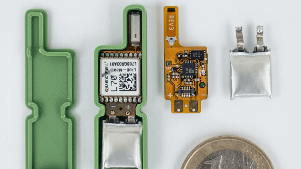
GPS has been a game-changing technology for all kinds of areas. Shipping, navigation, and even synchronization of clocks have become tremendously easier thanks to GPS. As a result of its widespread use, the cost of components is also low enough that almost anyone can build their own GPS device, and [Akio Sato] has taken this to the extreme with efforts to build a GPS tracker that uses the tiniest amount of power.

This GPS tracker is just the first part of this build, known as the air station. It uses a few tricks in order to get up to 30 days of use out of a single coin cell battery. First, it is extremely small and uses a minimum of components. Second, it uses LoRa, a low-power radio networking method, to communicate its location to the second part of this build, the ground station. The air station grabs GPS information and sends it over LoRa networks to the ground station which means it doesn’t need a cellular connection to operate, and everything is bundled together in a waterproof, shock-resistant durable case.

[Akio Sato] imagines this unit would be particularly useful for recovering drones or other small aircraft that can easily get themselves lost. He’s started a crowdfunding page for it as well. With such a long battery life, it’s almost certain that the operator could recover their vessel before the batteries run out of energy. It could also be put to use tracking things that have a tendency to get stolen.

Open-Source Farming Robot Now Includes Simulations

Farming is a challenge under even the best of circumstances. Almost all conventional farmers use some combination of tillers, combines, seeders and plows to help get the difficult job done, but for those like [Taylor] who do not farm large industrial monocultures, more specialized tools are needed. While we’ve featured the Acorn open source farming robot before, it’s back now with new and improved features and a simulation mode to help rapidly improve the platform’s software.

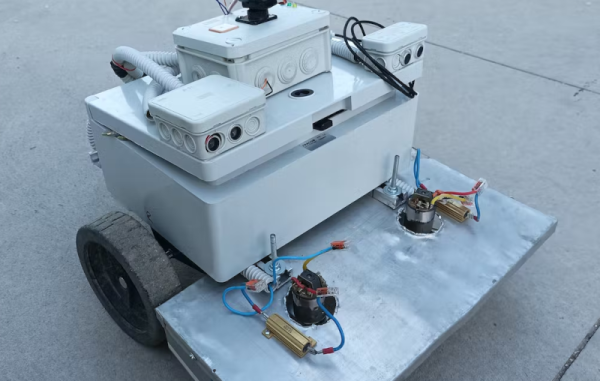
The first of the two new physical features includes a fail-safe braking system. Since the robot uses electric geared hub motors for propulsion, the braking system consists of two normally closed relays which short the motor leads in emergency situations. This makes the motors see an extremely high load and stops them from turning. The robot also has been given advanced navigation facilities so that it can follow custom complex routes. And finally, [Taylor] created a simulation mode so that the robot’s entire software stack can be run in Docker and tested inside a simulation without using the actual robot.

For farmers who are looking to buck unsustainable modern agricultural practices while maintaining profitable farms, a platform like Acorn could be invaluable. With the ability to survey, seed, harvest, and even weed, it could perform every task of larger agricultural machinery. Of course, if you want to learn more about it, you can check out our earlier feature on this futuristic farming machine.

NTP Server Gets Time From Space

Cheap GPS units are readily available nowadays, which is great if you have something that needs to be very precisely located. Finding the position of things is one of many uses for GPS, though. There are plenty of ways to take advantage of some of the ancillary tools that the GPS uses to determine location. In this case it’s using the precise timekeeping abilities of the satellites to build a microsecond-accurate network time protocol (NTP) server.

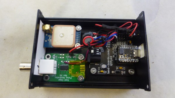
GPS works by triangulating position between a receiver and a number of satellites, but since the satellites are constantly moving an incredibly precise timing signal is needed in order to accurately determine location from all of these variables. This build simply teases out that time information from the satellite network and ignores the location data. There are only two parts to this build, a cheap GPS receiver and a Raspberry Pi, but [Austin] goes into great detail about how to set up the software side as well including installing PPS, GPSd, and then setting up the actual NTP server on the Pi.

While this is an excellent way to self-host your own NTP server if you don’t have Internet access (or just want to do it yourself), [Austin] does note that this is probably overkill on timekeeping as far as accuracy goes. On the other hand, the Raspberry Pi has no built-in real time clock of its own, so this might actually be a cost-competitive way of timekeeping even when compared to something more traditional like a DS3231 RTC module.

Continue reading “NTP Server Gets Time From Space”