Citizen Scientist: Hedy Lamarr

For all the destruction and human misery unleashed during World War II, it was also a time of incredible creativity and ingenuity. In America, it was a time when everyone wanted to pitch in. Young men and women enlisted and were shipped overseas, and those left behind kept the factories running full tilt. Even Hollywood went to war, with its steady output of films that gave people a little glamour and provided an escape from the horror and loss of the war. Hollywood stars lined up to entertain troops and raise money for the war effort, and many joined up and fought too.

But one Hollywood star made an unconventional contribution to the war effort, and in the process proved that beauty and brains are not always mutually exclusive. This is the story of Hedy Lamarr, movie star and inventor.

“The Most Beautiful Woman in the World”

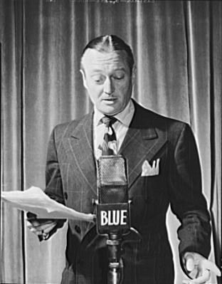
By the time she was 23 in 1937, Hedwig Eva Maria Kiesler was a genuine film star in her native Austria. She was also trapped in an unhappy marriage to a rich and powerful Austrian munitions magnate, Fritz Mandl. Hedy was miserable as a trophy wife, adorning the dining room as her husband entertained rich and powerful guests – including Mussolini and Hitler – over long dinners in one of his mansions. They dismissed her; clearly a woman so beautiful could have nothing else to offer, an empty head perched on a graceful neck. But she was far from stupid, and while her husband discussed business with the men who were building the Axis arsenal, Hedy listened and learned.

Continue reading “Citizen Scientist: Hedy Lamarr”

Teeny Tiny Very Small – Atomic Resolution And The Home Hobbyist

Atoms are small. Really small. You just won’t believe how minusculely microscopically mindbogglingly small they are. I mean you may think it’s a short way down the road to the chemist’s, but that’s just peanuts to atoms.

Atoms really are small. The atomic radius of a carbon atom is on the order of 0.1 nanometers, that’s 0.0000001 millimeters. It’s hard to grasp how fantastically small this is compared to objects we generally encounter, but as a starting point I’d recommend looking at the “Powers of Ten” video found below whose ability to convey the concept has been unrivaled since it was published in 1977.

The term nanometer might be most familiar from the semiconductor industry, and its seemingly unstoppable march to smaller feature sizes. Feature sizes currently hover somewhere around the 10 nanometer mark. So while these multi-billion dollar facilities can achieve 10nm precision it’s somewhat surprising that sub-nanometer feature size positioning, and fabrication techniques are available at relatively low cost to the hacker hobbyist.

In this article we’re going to review some of the amazing work demonstrated by hobbyists in the area of the very very small through use of cutting edge, but low cost techniques.

Continue reading “Teeny Tiny Very Small – Atomic Resolution And The Home Hobbyist”

Navigating The Oceans Is Deadly Without A Clock

I came across an interesting question this weekend: how do you establish your East/West location on the globe without modern technology? The answer depends on what you mean by “modern”, it turns out you only have to go back about three centuries to find there was no reliable way. The technology that changed that was a clock; a very special one that kept accurate time despite changing atmospheric conditions and motion. The invention of the Harrison H1 revolutionized maritime travel.

We can thank Andy Weir for getting me onto this topic. I just finished his amazing novel The Martian and I can confirm that George Graves’ opinion of the high quality of that novel is spot on. For the most part, Andy lines up challenges that Mark Watney faces and then engineers a solution around them. But when it came to plotting location on the surface of Mars he made just a passing reference to the need to have accurate clocks to determine longitude. I had always assumed that a sextant was all you needed. But unless you have a known landmark to sight from this will only establish your latitude (North/South position).

Continue reading “Navigating The Oceans Is Deadly Without A Clock”

Ethics In Engineering: Volkswagen’s Diesel Fiasco

Every so often – and usually not under the best of circumstance – the field of engineering as a whole is presented with a teaching moment. Volkswagen is currently embroiled in a huge scandal involving emissions testing of 11 Million diesel cars sold in recent years. It’s a problem that could cost VW dearly, to the tune of eighteen Billion dollars in the US alone, and will, without a doubt, end the careers of more than a few Volkswagen employees. In terms of automotive scandals, this is bigger than Unsafe at Any Speed. This is a bigger scandal than the Ford Pinto’s proclivity to explode. This is engineering history in the making, and an enormously teachable moment for ethics in engineering.

Continue reading “Ethics In Engineering: Volkswagen’s Diesel Fiasco”

This Is What A Real Bomb Looks Like

In 1980, Lake Tahoe, Nevada was a popular tourist spot. The area offered skiing, sailing, hiking in the mountains, and of course, gambling on the Nevada side of the lake. It was in this somewhat unlikely place where the authorities found the largest improvised bomb seen to that date in the USA.

Harvey’s casino was opened by former butcher Harvey Gross in 1944. In less than 20 years it grew to a 192 room, 11 story hotel casino. Thousands of people played Harvey’s slot machines and table games. Some were winners, but most were losers. John Birges was one of the latter. Formerly a successful landscaping company owner worth millions, he lost all of it to his gambling addiction.

Born in Hungary in 1922 as János Birges, John grew up in Budapest. When WWII hit, he flew an Me-109 for the Luftwaffe. He was arrested by the Gestapo for disobeying orders during the war, but was released. After the war, he again found himself in hot water – this time with the Russians. He was arrested in 1948 and charged with espionage. His sentence was 25 years of hard labor in the Gulag. The stories vary, but most agree that Birges was able to escape his work camp by detonating a bomb as a diversion.

In 1957 Birges and his wife Elizabeth immigrated to California. He changed his name from János to John to fit in. The couple had two sons, Johnny and Jimmy. John built up a successful landscaping business and bought a restaurant, working his way into the millionaires’ club. From the outside, they were the perfect example of the American dream.

Appearances can be deceiving. Behind closed doors, Birges was a right bastard to his family. He beat his wife and his children, even forcing them to kneel on gravel when they disobeyed him. Eventually, Johnny left home to escape his father’s fists. Elizabeth filed for divorce, and was later found dead under mysterious circumstances. Birges began gambling heavily, especially at Harvey’s Wagon Wheel casino in Lake Tahoe. He eventually burned through his personal savings, as well as the income from his businesses. The once millionaire was now penniless, but he had a plan. Just as a bomb had helped him escape the Gulag, he’d use a bomb to extort his money back from Harvey’s.

Continue reading “This Is What A Real Bomb Looks Like”

Let Skynet Become Self-Aware!

Not so long ago, it was hard to fly. Forget actual manned aircraft and pilots licenses; even flying model aircraft required hours of practice, often under the tutelage of a master at a flying field. But along with that training came an education in the rules of safe flight, including flying at a designated airfield and watching out for obstacles.

We accidentally messed that up. We in the drone industry made aircraft super easy to fly — perhaps too easy to fly. Thanks to smart autopilots and GPS, you can open a box, download an app and press “take off”. The copter will dutifully rise into the air and wait there for further instructions — no skill required. And it will do this even if you happen to be in an NFL football stadium in the middle of a big game. Or near an airport. Or in the midst of a forest fire.

The problem is that along with taking training out of the process of flying a drone, we inadvertently also took out the education process of learning about safe and responsible flight. Sure, we drone manufacturers include all sorts of warning and advisories in our instructions manual (which people don’t read) and our apps (which they swipe past), and companies such as DJI and my own 3DR include basic “geofencing” restrictions to try to keep operators below 400 feet and within “visual line of sight”. But it’s not enough.

Every day there are more reports of drone operators getting past these restrictions and flying near jetliners, crashing into stadiums, and interfering with first responders. So far it hasn’t ended in tragedy, but the way things are going it eventually will. And in the meantime, it’s making drones increasingly controversial and even feared. I call this epidemic of (mostly inadvertent) bad behavior “mass jackassery”. As drones go mass market, the odds of people doing dumb things with them reach the singularity of certainty.

We’ve got to do something about this before governments do it for us, with restrictions that catch the many good uses of drones in the crossfire. The reality is that most drone operators who get in trouble aren’t malicious and may not even know that what they’re doing is irresponsible or even illegal. Who can blame them? It’s devilishly hard to understand the patchwork quilt of federal, state and local regulations and guidelines, which change by the day and even the hour based on “airspace deconfliction” rules and FAA alerts written for licensed pilots and air traffic control. Many drone owners don’t even know that such rules exist.

Drones Themselves Should Know Rules of Each Area

Fortunately, they don’t have to. Our drones can be even smarter — smart enough to know where they should and shouldn’t fly. Because modern drones are connected to phones, they’re also connected to the cloud. Every time you open their app, that app can check online to find appropriate rules for flight where you are, right then and there.

Here’s how it works. The app sends four data fields to a cloud service: Who (operator identifier), What (aircraft identifier), Where (GPS and altitude position) and When (either right now or a scheduled time in the case of autonomous missions). The cloud service then returns a “red light” (flight not allowed), a “green light” (flight allowed, with basic restrictions such as a 400 feet altitude ceiling), or “yellow light” (additional restrictions or warnings, which can be explained to the operator in context and at the point of use).

image01

Right now industry groups such as the Dronecode Foundation, the Small UAV Coalition (I help lead both of them, but this essay just reflects my own personal views) and individual manufacturers such as 3DR and DJI are working on these “safe flight” standards and APIs. Meanwhile, a number of companies such as Airmap and Skyward are building the cloud services to provide the up-to-date third-party data layer that any manufacturer can use. It will start with static no-fly zone data such as proximity to airports, US national parks and other banned airspace such as Washington DC. But it will quickly add dynamic data, too, such as forest fires, public events, and proximity to other aircraft.

(For more on this, you can read a white paper from one of the Dronecode working groups here and higher level description here.)

There’s Always a Catch

Of course, this system isn’t perfect. It’s only as good as the data it uses, which is still pretty patchy worldwide, and the ways that the manufacturers implement those restrictions. Some drone makers may choose to treat any area five miles from an airport as a hard ban and prohibit all flight in that zone, even at the cost of furious customers who had no idea they were five miles from an airport when they bought that toy at Wal-mart (nor do they think it should matter, since it’s just a “toy”). Other manufacturers may choose to make a more graduated restriction for the sake of user friendliness, adding a level of nuance that is not in the FAA regulation. They might ban, say, flight one mile from an airport, but only limit flight beyond that to something like 150ft of altitude (essentially backyard-level flying).

That’s a reasonable first step. But the ultimate safe flight system would go a lot further. It would essentially extend the international air traffic control system to millions of aircraft (there are already a million consumer drones in the air) flown by everything from children to Amazon. The only way to do that is to let the drones regulate themselves (yes, let Skynet become self-aware).

Peer-to-peer Air Traffic Control

There’s a precedent for such peer-to-peer air traffic control: WiFI. Back in the 1980s, the FCC released spectrum in the 2.4 Ghz band for unlicensed use. A decade later, the first 802.11 standards for Wifi were released, which was based on some principles that have application to drones, too.

  1. The airspace used is not otherwise occupied by commercial operators
  2. The potential for harm is low (in the case of WiFi, low transmission power. In the case of drones, low kinetic energy due to the weight restrictions of the “micro” category)
  3. The technology has the capability to self-”deconflict” the airspace by observing what else is using it and picking a channel/path that avoids collisions.

That “open spectrum” sandbox that the FCC created also created a massive new industry around WiFi. It put wireless in the hands of everyone and routed around the previous monopoly owners of the spectrum, cellphone carriers and media companies. The rest was history.

Quadcopter ThumbWe can do the same thing with drones. Let’s create an innovation “sandbox” with de minimus regulatory barriers for small UAVs flying within very constrained environments. The parameters of the sandbox could be almost anything, as long as they’re clear, but it should be kinetic energy and range based (a limit of 2kg and 20m/s at 100m altitude and 1,000m range within visual line of sight would be a good starting point).

As in the case of open spectrum, in relatively low risk applications, such as micro-drones, technology can be allowed to “self-deconflict the airspace” without the need for monopoly exclusions such as exclusive licences or regulatory permits. How? By letting the drones report their position using the same cellphone networks they used to get permission to fly in the first place. The FAA already has a standard for this, called ADS-B, which is based on transponders in each aircraft reporting their position. But those transponders are expensive and unnecessary for small drones, which already know their position and are connected to the cloud. Instead, they can use “virtual ADS-B” to report their position via their cell network connections, and that data can be injected into the same cloud data services they used to check if their flight was safe in the first place.

Once this works, we’ll have a revolution. What WiFi did the telecoms industry, autonomous, cloud-connected drones can do to the aerospace industry. We can occupy the skies, and do it safely. Technology can solve the problems it creates.


About the Author

judge-thumb-AndersonChris Anderson (@Chr1sa) is the CEO of 3D Robotics and founder of DIY Drones. From 2001 through 2012 he was the Editor in Chief of Wired Magazine. Before Wired he was with The Economist for seven years in London, Hong Kong and New York.

The author of the New York Times bestselling books The Long Tail and Free as well as the Makers: The New Industrial Revolution.

His background is in science, starting with studying physics and doing research at Los Alamos and culminating in six years at the two leading scientific journals, Nature and Science.

In his self-described misspent youth [Chris] was a bit player in the DC punk scene and amusingly, a band called REM. You can read more about that here.

Awards include: Editor of the Year by Ad Age (2005). Named to the “Time 100,” the newsmagazine’s list of the 100 most influential people in the world (2007). Loeb Award for Business Book of the Year (2007). Wired named Magazine of the Decade by AdWeek for his tenure (2009). Time Magazine’s Tech 40 — The Most Influential Minds In Technology (2013). Foreign Policy Magazine’s Top 100 Global Thinkers (2013).

See Actual Microwaves — No More Faking It

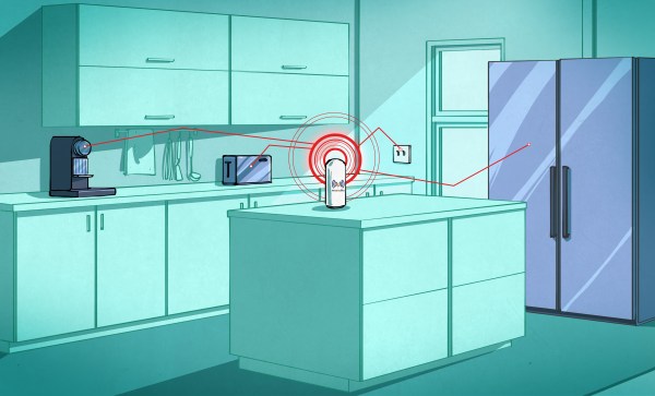
Last week we saw a lot of interest in faux visualization of wireless signals. It used a tablet as an interface device to show you what the wireless signals around you looked like and was kind of impressive if you squinted your eyes and didn’t think too much about it. But for me it was disappointing because I know it is actually possible to see what radio waves look like. In this post I will show you how to actually do it by modifying a coffee can radar which you can build at home.

The late great Prof. David Staelin from MIT once told me once that, ‘if you make a new instrument and point it at nature you will learn something new.’ Of all the things I’ve pointed Coffee Can Radars at, one of the most interesting thus far is the direct measurement and visualization of 2.4 GHz radiation which is in use in our WiFi, cordless phones (if you still have one) and many other consumer goods. There is no need to fool yourself with fake visualizations when you can do it for real.

Continue reading “See Actual Microwaves — No More Faking It”