Everyone talks about the weather. This is doubly true for sailors, where bad weather could mean a very bad day. So it isn’t surprising that navies around the world have had a keen interest in weather forecasting. But how did you predict the weather before modern instruments, radar, and satellite images? Vice Admiral Robert FitzRoy had great faith in “storm glasses,” a glass chamber containing some chemicals that he didn’t invent, but did document and promote heavily during the 1860s.
Did it work? Apparently not, but the device is still interesting in its own right. FitzRoy was a pioneer of meteorology, replacing folklore with actual observations and attempts at scientific rigor. While he did arm observation stations with conventional things like thermometers and barometers, he was also a proponent of the weather glass. Continue reading “FitzRoy’s Glass: Victorian Weather Marvel Or Glorified Thermometer?”→
At a time when so-called “artificial intelligence” seems inescapable, we were encouraged to see news that Amazon will be cracking down on third-party sellers that use AI-generated images for their product listings. They won’t be prevented from using the images, but they will need to clearly indicate that they don’t represent reality and were produced via artificial means. This comes in response to a recently enacted New York law that requires the disclosure of AI in advertisements.
Will this be the end of the cat sleeping bag?
But it’s not quite a clear cut as it might seem on the surface, as the New York law is actually about AI-generated people rather than products. Specifically, it’s designed to make it clear when a “synthetic performer” has been used in place of a human actor. As such, it would appear that the easiest way for Amazon sellers to dodge the new rule is to simply not include any humans in their AI slop images and videos. In other words, they can continue to post fake pictures of products without having to inform the consumer so long as they don’t show a fake person holding it.
Under normal circumstances we’d leave something like this next one for our weekly security column, but the utter lack of security in the Pope’s official “Click To Pray” mobile application revealed by researcher BobDaHacker on Friday is just too good a story to pass up. For one thing, who knew that there was an “official” prayer app? We don’t dabble in theology around these parts, but we’re fairly sure the good book didn’t mention anything about requiring a smartphone to give praise.
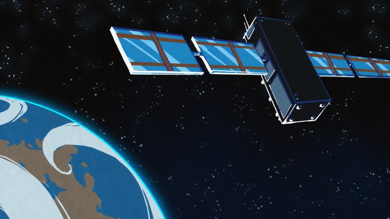
Some breaking news from geostationary orbit, as the National Oceanic and Atmospheric Administration (NOAA) has announced that its newest Geostationary Operational Environmental Satellite (GOES) satellite unexpectedly went offline last night, and as of this morning, remains stuck in safe mode.
Launched in June of 2024, GOES-19 is one of four operational weather satellites that NOAA operates to provide forecast data and severe weather monitoring for the entire Western Hemisphere. The satellite is specifically responsible for covering the continental United States, Central and South America, as well as the Atlantic Ocean. This makes it a particularly critical asset even under normal circumstances, but the fact that it’s gone blind during the Atlantic hurricane season and while smoke from the raging Canadian wildfires is drifting over the Northeast and making the skies over Boston and New York City look like Mars is something of a worst-case scenario.
The good news is that two of the four satellites operate as orbital spares — the satellite that GOES-19 replaced in 2024, GOES-16, is still operational and can stand in as a backup for its coverage area. Obviously, it’s quite a bit older, having launched back in 2016, but it’s of the same design as GOES-19, and in good health, so there should be no degradation of service.
Still, getting GOES-19 back online will be critical for NOAA and the National Weather Service, and we expect they’ll be providing regular updates as the situation develops. Stay tuned.
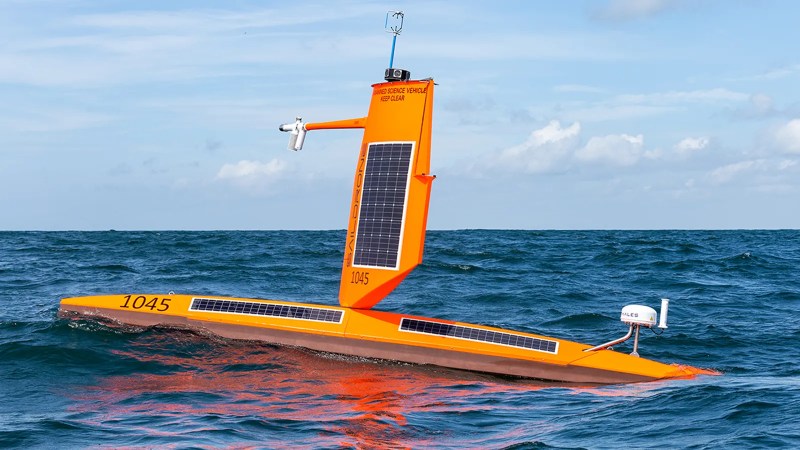
Hurricanes can cause widespread destruction, so early forecasting of their strength is important to protect people and their homes. The US National Oceanic and Atmospheric Administration (NOAA) is using saildrones to get better data from inside these monster storms.
Rising ocean temperatures due to climate change are causing hurricanes to intensify more rapidly than in the past, although modeling these changes is still a difficult task. People on shore need to know if they’re in store for a tropical storm or a high strength hurricane to know what precautions to take. Evacuating an area is expensive and disruptive, so it’s understandable that people want to know if it’s necessary.
Starting with five units in 2021, the fleet has gradually increased in size to twelve last summer. These 23ft (7m), 33ft (10m), or 65ft (20m) long vessels are propelled by wing sails and power their radio and telemetry systems with a combination of solar and battery power. No fossil fueled vessel can match the up to 370 days at sea without refueling that these drones can achieve, and the ability to withstand hurricane winds and sea conditions allow scientists an up-close-and-personal look at a hurricane without risking human lives.
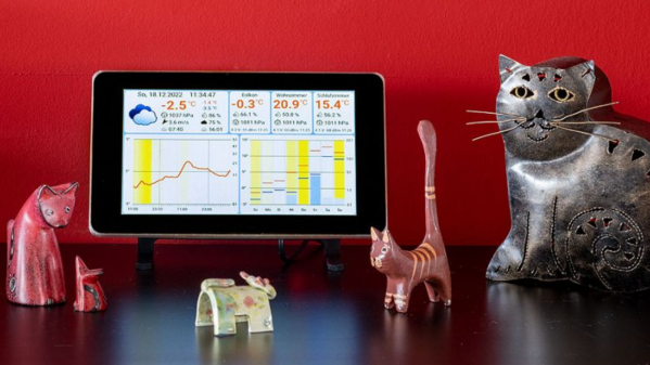
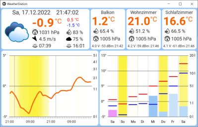
Online weather services are great for providing generic area forecasts, but they don’t provide hyperlocal data specific to your location. [Harald Kreuzer] needed both and built a Raspberry Pi Weather Station that provides weather forecasts for the next 7 days as well as readings from local sensors. The project is completely open source and based on a Raspberry Pi base station which connects to ESP32 based sensor nodes and online services to nicely present the data on a 7″ touch screen display.
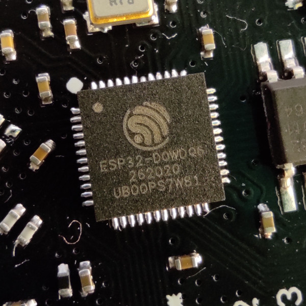
The architecture is quite straightforward. The ESP32 based sensor nodes publish their readings to an MQTT broker running on the Raspberry Pi. The Pi subscribes to these sensor node topics to pick up the relevant sensor data. This makes it easy to add additional sensor nodes in future. Weather forecast data is collected by connecting to the OpenWeatherMap API. All of the collected information is then displayed through an app built using the Kivy: open source Python app development framework. Continue reading “Raspberry Pi Weather Station Features Wireless Sensor Nodes”→
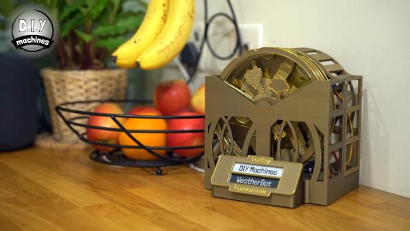
These days, if you don’t fancy watching morning TV, you can always get an update on the day’s weather from your smartphone, computer, or any one of a series of other connected devices. However, if you’re looking for a more fun way to see what’s in store, this weather diorama from [Lewis] of DIY Machinesmight be just what you’re looking for.
The build uses an ESP32 as the brains of the project, responsible for querying the Internet for up-to-date weather information. This info is then displayed on a 2.9″ e-ink display, showing the temperature, chance of rain, and wind speed predicted for the local area. So far, so straightforward.
However, where it gets really creative is the use of laser-cut “scene discs” with different graphics on them to represent different weather conditions. They can alternatively be 3D printed,too. These are rotated via servos controlled by the ESP32, allowing the diorama to display a representative scene informed by the current forecast. If there’s snow coming, you’ll see a snow man, but if things are looking fine, you’re more likely to see a woman strolling with a dog.
It’s a fun way to learn about what Mother Nature has in store, and would look great on any breakfast bar to boot. We’ve seen some great builds from [Lewis] before, too, like this amazing seven-segment clock shelf.
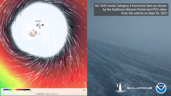
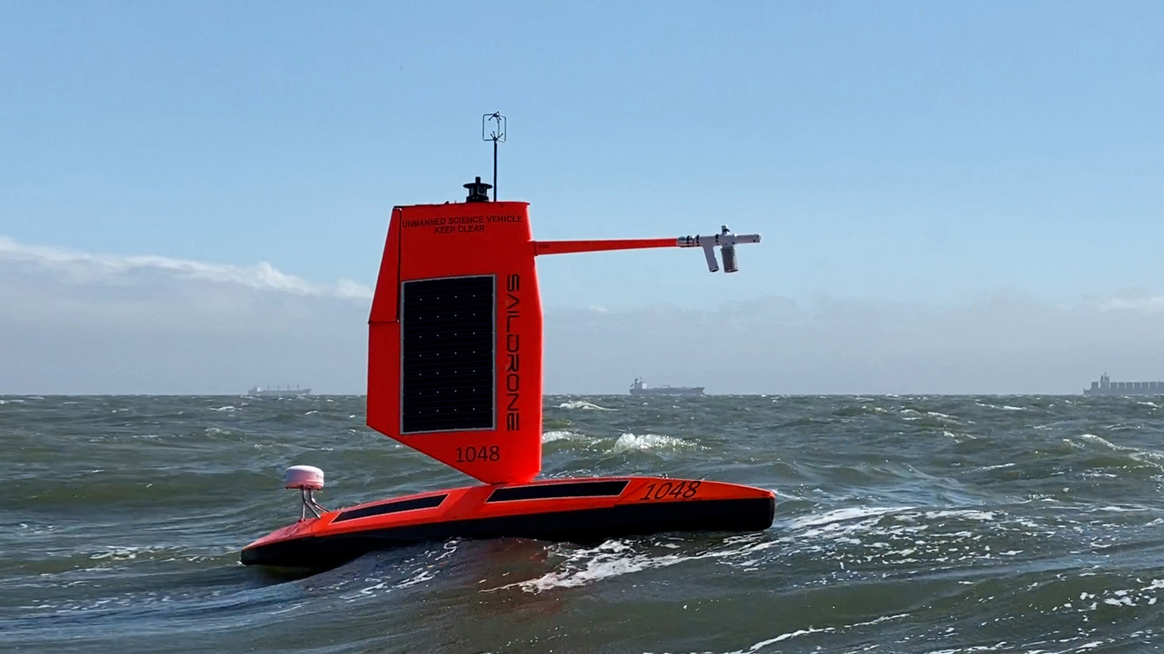
It is unlikely that as a young lad [Richard Jenkins] would had have visions of sailing into the eye of a Category-4 hurricane. Yet that’s exactly what he’s done with the Explorer 1045, an uncrewed sailing vehicle built by his company, Saildrone. If that weren’t enough, footage from the vessel enduring greater than 120 MPH (almost 200 km/h) winds and 50 foot (15 M) waves was posted online the very next day, and you can see it below the break. We’re going to take a quick look at just two of the technologies that made this possible: Advanced sails and satellite communication. Both are visible on Explorer 1045’s sibling 1048 as seen below:
Saildrone Explorer 1048, a sibling of Explorer 1045, each one of five vessels equipped with a “hurricane wing”
The most prominent feature of course is the lack of a traditional sail. You see, from 1999-2009, [Richard Jenkins] was focused on setting the land world speed record for a wind powered vehicle. He set that record at 126.1 mph by maturing existing sail wing technology. [Richard] did away with conventional rigging and added a boom with a control surface on it, much like the fuselage and empennage of a sailplane.
Instead of adjusting rigging, the control surface could be utilized to fly the wing into its optimal position while using very little energy. [Richard] has been able to apply this technology at his company, Saildrone. The 23 foot Explorer vessel and its big brothers are the result.
How is it that the world was treated to the view from inside the eye of a hurricane only a day after the video was recorded? If you look at the stern of the vessel, you can see a domed white cylinder. It is a satellite communication base station called the Thales VesseLINK. Thales is one of the partner companies that built the satellites for the Iridium NEXT fleet, which has 66 operational satellites in Low Earth Orbit. The Iridium Certus service uses its L-Band (1.6 GHz) signal to provide up to 352 kbps of upload speed and 704 kbps down. While not blazing fast, the service is available anywhere in the world and is reliable because it is not prone to rain fade and other weather based interference.
With just these two recent innovations, the Explorer 1045 was able to sail to the eye of a hurricane, record footage and gather data, and then ship it home just hours later. And we’re hardly exploring the tip of the iceberg. More than just sailboat based cameras, these scientific instruments are designed to survive some of the harshest environments on the planet for over a year at a time. They are a marvel of applied engineering, and we’re positive that there are some brilliant hacks hiding under that bright orange exterior.




 The architecture is quite straightforward. The ESP32 based sensor nodes publish their readings to an MQTT broker running on the Raspberry Pi. The Pi subscribes to these sensor node topics to pick up the relevant sensor data. This makes it easy to add additional sensor nodes in future. Weather forecast data is collected by connecting to the OpenWeatherMap API. All of the collected information is then displayed through an app built using the Kivy: open source Python app development framework.