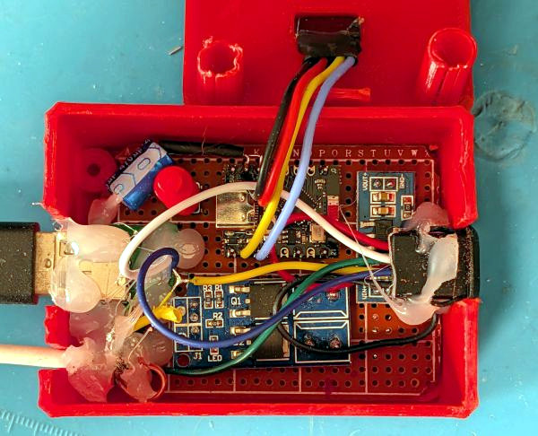
Many of us have made electric transport of some form, whether a Hacky Racer, and e-bike, a go-kart, or whatever. We have invariably bought a motor, or if we are really adventurous, repurposed a car alternator. Not [Birdbrain] though, because she’s designed and built her own from first principles.
The video below goes into significant detail on the design of her motor, looking at cores, wire sixes, and configurations with a useful simulation along the way. We particularly like the way she uses a bandsaw to cut transformer laminations to shape for her core. The 3D printed housing initially isn’t strong enough for the forces induced by the magnets, but she attacks that problem with a new print. The motor works well, and as an added bonus there’s an introduction to the different types of motor driver. It seems the cheap ones don’t deliver a good waveform for the characteristics of the motor. Sadly she doesn’t fit it to a real bike in the video, but it seems this thing might just work.
After the digital camera rose to prominence, it became a cool hobby to keep taking photos on film. It was even cooler if you did the same with an old motion picture camera. The retro film revival has kept a dedicated bunch of photo labs in business over the years, but it’s still possible to save some cash on development by doing it yourself. If that’s your game, you might try mixing up your own development chemicals.
As explained by [No Grain No Gain], it’s quite possible to mix up your own ECN-2 chemistry from scratch if you know what you’re doing. ECN-2 is the chemistry you’ll want if you’re trying to develop any of Kodak’s Vision3 films, along with CineStill films.
The problem with traditional methods of making developer is that once it’s mixed up, it doesn’t keep well, and the more you use it, the worse the quality gets. To beat this problem, this method involves producing two stock solutions which can be kept on the shelf for long periods of time. They can then be combined together with a little CD-3 developer on an as-needed basis. This makes it easy to always have fresh developer on hand for the best possible results on every roll processed. To make everything, you’ll need sodium sulfite, potassium bromide, sodium carbonate, sodium bicarbonate, and the specialist CD-3 developing agent. It’s then a simple job to mix up the dry chemicals with a bunch of distilled water to make the two necessary solutions to keep on hand. The video also explains how to deal with RemJet films if you happen to be shooting those.
[No Grain No Gain] estimates that this method can cut the cost of development to as little as 50 cents a roll. There’s plenty of labor involved, but if you want the freshest, best developer on hand for your home lab, it’s a method worth considering.
The vibrobot – a vibrating motor and battery attached to the head of a brush – isn’t truly a robot, since its movement can’t be controlled, but it’s whetted the interest of many future roboticists. With a clever control method, though, it is in fact possible to drive them in any desired direction while using only one motor.
[Namaskar Mitro] based the design of this robot on this research paper; if the vibrating motor is mounted at an angle above the base of the robot, it causes the bot to rotate, and if the motor is mounted off-center from the center of mass, the robot moves in a circle. Crucially, reversing the direction of the motor’s rotation reverses the direction of the robot’s rotation. By rapidly switching the direction of rotation, the bot can move in a series of short, shallow arcs which approximate a straight line.
The robot which [Namaskar] built was based on an ESP-01F microcontroller, which let it be remote-controlled over Wi-Fi. It used a DRF8212 motor driver to control a vibrating pager motor, which was housed inside a 3D-printed enclosure. To move in a straight line, the ESP-01F switches the motor’s direction every 250 milliseconds, which still produces a slightly erratic movement. It can, however, approximately follow a traced path.
Building your own sprinkler system controller isn’t that difficult on the face of it, but what happens when your system starts to grow, adding more distant areas? To tackle this, [Vinnie] leveraged the tried-and-true RS-485 differential pairs to communicate reliably with ever-more-spread-out valves on his farm’s irrigation system.
The system uses a Raspberry Pi to control when each valve turns on and for how long. It does this via a custom RS-485 valve master board, whose code and design files are on GitHub. The master board communicates with the Pi over I2C and issues RS-485 commands while controlling the 12V line to the valves. Toggling the 12V supply is a smart move it lets [Vinnie] save power by not keeping the valves energized when idle.
At the valves themselves lives a valve node board (also on the GitHub repo). Each node has a unique address so it knows when its name is called to open or close a valve. The valves are latching solenoids, ideal because they don’t require constant current during the watering cycle. The Valve Nodes also support their own protocol to report state, firmware version, and allow in-situ configuration.
Be sure to head over to [Vinnie]’s project page and check out all the work that went into this great DIY irrigation control system, along with the thoughtful boards and tools he made to help others set it up. This is a welcome addition to the sprinkler-related projects we’ve seen.
If you want to maximize the life of your lithium-ion batteries, proper storage voltage is critical. That is, don’t store them empty, and don’t store them completely full either. “Almost fully charged” is a sweet spot for occasional-use devices. Sadly, this is easier said than done. While many devices use integrated rechargeable batteries these days, most provide no method of limiting charge level. That’s where [DaverDavid]’s ChargeCap comes in.
By sampling charge current and disconnecting when it drops to 50 percent of peak, charging is reliably stopped when the target device is 80 to 90 percent charged, regardless of cell count or capacity.
ChargeCap sits between a USB charger and target device, disconnecting when it detects that recharging is 80 to 90 percent complete. This is particularly useful for maximizing the cell life of devices that see only intermittent use.
The way ChargeCap does this is clever, and relies on the fact that all lithium-ion charging curves look the same regardless of cell capacity or cell count. Charge current remains at pretty much the same level for most of the charging process, but tapers off quickly (and in a linear fashion) as cells approach their maximum capacity. That’s because charging a battery is a lot like blowing up a balloon: the first breaths are easy, but once the balloon fills out, every breath needs to push harder than the last.
ChargeCap works by sampling the peak charge current at the beginning of the charge cycle, then detecting when it drops below 50 percent of peak, at which point charging is stopped. The result is a device that reliably charges to 80 to 90 percent of capacity, and no more. ChargeCap uses an ESP32-C3 and a small OLED display that, as a nice touch, inverts colors to signal charge completion. Design files and code are at the GitHub repository.
The HP-41C analog on my phone gives the right answer.
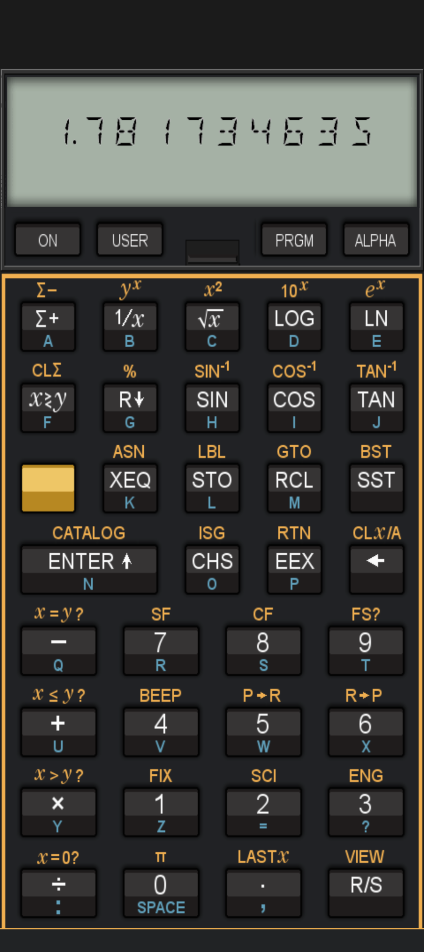
Three resistors in parallel: 4.7 k,Ω 22 kΩ, and 3.3 kΩ. Quick! What’s the equivalent value? You can estimate it, of course, but if you want the actual 1.8 kΩ (approximately) answer, you probably reached for some kind of calculating aid. I have two slide rules on my desk, and plenty more a few steps away, but I don’t use them much, honestly. I have a very old HP-41C — arguably the best calculator ever made — but I am usually afraid to use it as it is almost 50 years old and difficult to repair. I also have an HP-28S on my desk, a replica HP-41C, and a few others in desk drawers. There are also dozens of calculators on my desktop computer, my phone –including the official HP Prime app — and the web browser.
I often see newer calculators from HP, like the Prime G2, or “new” HP-like calculators like the ones from SwissMicros, and think I should pick one up. Well, technically, HP licensed their calculators to Moravia, so even a “real” HP calculator isn’t from HP anymore. But, in the end, I always realize that my need for a physical calculator is so diminished that I can’t justify buying anything new, and I can barely even spring for a $10 one at the thrift store unless it is a real collectible.
Mind you, I’m not talking about RPN versus algebraic. I could say the same thing for TI, Casio, or Sharp calculators. I just don’t know why I need one anymore, even though I still, for some strange reason, want them.
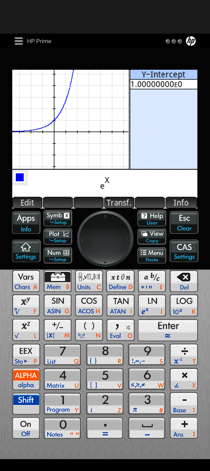
The Prime seems impressive, if I could ever find time to finish reading the manual.
For the record, I did use an HP-41C to check the resistor math, but it was in the form of an app on my phone, not a real calculator. On the same computer I’m writing this on, I have HP-41C emulators, the Prime emulator, and a bunch of other calculators. Yet I still pick up my phone and use the familiar key layout of the HP-41C. I don’t know why. The replica 41C, unfortunately, has a landscape-oriented keyboard, so while I like it, it doesn’t satisfy my finger’s muscle memory.
Which leads to this Ask Hackaday. Do you use a calculator? Why? If you don’t, do you use a fake calculator on your phone or computer? Or do you just send your math to Google or Wolfram? I suspect some of the answer will be generational. I was in high school before calculators started showing up in schools, but they took over quickly.
There is something satisfying about having a purpose-built device to do your math. No long boot sequence. No switching apps. No messages coming in while you are typing in numbers. For the ultimate convenience, you could wear it on your wrist. The Apollo mission that docked with a Russian spacecraft carried an HP-65, and nine early Space Shuttle missions used an HP-41C. But even astronauts now don’t have a standard-issue calculator. Pilots sometimes use electronic E6Bs, but many still use the mechanical version.
Of course, I do collect slide rules, so maybe I just need to accept that calculators are yet another tech relic to collect. But someone is still buying them. I’d like to be one of them.
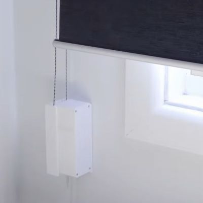
Most people love window shades, but many dislike the tedium of having to open and close them over the course of each day. While there are automation options here, if you’re in a rental place like [Rooster Robotics], then you’d prefer something less intrusive, as well as less cloud-bound. This is basically why he opted to build his own solution from scratch to open and close roller shades via Home Assistant.
The comments to the video helpfully point out that technically his point about there not being commercial options with a forced remote account ‘feature’ is false, as the Aqara Roller Shade Driver E1 for example is just a regular Zigbee device which can be used with a wide range of home automation ecosystems. That said, it’s always nice to have your own device that you fully control.
Of course, these devices are deceptively simple, as you still have to somehow know how far open the curtain is, which is also useful if you just want to open the curtain a certain amount. The other issue is the need to have the motor parallel with the wall unless you enjoy having a big wart sticking out from the wall.
Solving the first issue was attempted with a Hall effect sensor, and the second with angled gearing. With some refinements this led to a functioning design, allowing the development of a custom PCB with an ESP32-S3 module for WiFi control. In the final design the Hall effect sensor and magnets were replaced with an AS5600 magnetic rotatory position sensor that requires just one magnet and offers a much higher resolution.
Currently the design files are not available, but [Rooster Robotics] has indicated that they are looking at open sourcing the files in the future.